Category:Maps of agriculture in Côtes-d'Armor
Jump to navigation
Jump to search
Departments of Metropolitan France: Ain [01] · Aisne [02] · Allier [03] · Alpes-de-Haute-Provence [04] · Hautes-Alpes [05] · Alpes-Maritimes [06] · Ardèche [07] · Ardennes [08] · Ariège [09] · Aube [10] · Aude [11] · Aveyron [12] · Bouches-du-Rhône [13] · Calvados [14] · Cantal [15] · Charente [16] · Charente-Maritime [17] · Cher [18] · Corrèze [19] · Corse-du-Sud [2A]† · Haute-Corse [2B]† · Côte-d’Or [21] · Côtes-d'Armor [22] · Creuse [23] · Dordogne [24] · Doubs [25] · Drôme [26] · Eure [27] · Eure-et-Loir [28] · Finistère [29] · Gard [30] · Haute-Garonne [31] · Gers [32] · Gironde [33] · Hérault [34] · Ille-et-Vilaine [35] · Indre [36] · Indre-et-Loire [37] · Isère [38] · Jura [39] · Landes [40] · Loir-et-Cher [41] · Loire [42] · Haute-Loire [43] · Loire-Atlantique [44] · Loiret [45] · Lot [46] · Lot-et-Garonne [47] · Lozère [48] · Maine-et-Loire [49] · Manche [50] · Marne [51] · Haute-Marne [52] · Mayenne [53] · Meurthe-et-Moselle [54] · Meuse [55] · Morbihan [56] · Moselle [57] · Nièvre [58] · Nord [59] · Oise [60] · Orne [61] · Pas-de-Calais [62] · Puy-de-Dôme [63] · Pyrénées-Atlantiques [64] · Hautes-Pyrénées [65] · Pyrénées-Orientales [66] · Bas-Rhin [67] · Haut-Rhin [68] · Rhône [69D]‡ · Haute-Saône [70] · Saône-et-Loire [71] · Sarthe [72] · Savoie [73] · Seine-Maritime [76] · Seine-et-Marne [77] · Yvelines [78] · Deux-Sèvres [79] · Tarn [81] · Tarn-et-Garonne [82] · Var [83] · Vaucluse [84] · Vendée [85] · Vienne [86] · Haute-Vienne [87] · Vosges [88] · Yonne [89] · Territoire de Belfort [90] · Essonne [91] · Val-de-Marne [94] · Val-d'Oise [95]
Subcategories
This category has only the following subcategory.
Media in category "Maps of agriculture in Côtes-d'Armor"
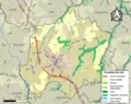
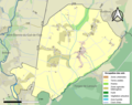
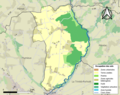
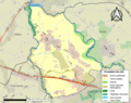
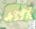
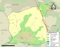
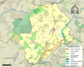
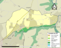
The following 92 files are in this category, out of 92 total.
-
 22002-Andel-Sols.png 3,270 × 2,598; 2.2 MB
-
 22004-Bégard-Sols.png 3,270 × 2,598; 3.49 MB
-
 22012-La Bouillie-Sols.png 3,270 × 2,598; 2.12 MB
-
 22015-Bréhand-Sols.png 3,270 × 2,598; 3.25 MB
-
 22019-Bringolo-Sols.png 3,270 × 2,598; 1.93 MB
-
 22027-Le Cambout-Sols.png 3,270 × 2,598; 1.97 MB
-
 22028-Camlez-Sols.png 3,270 × 2,598; 2.04 MB
-
 22035-Les Champs-Géraux-Sols.png 3,270 × 2,598; 2.01 MB
-
 22036-La Chapelle-Blanche-Sols.png 3,270 × 2,598; 1.78 MB
-
 22042-Coatréven-Sols.png 3,270 × 2,598; 1.86 MB
-
 22043-Coëtlogon-Sols.png 3,270 × 2,598; 2.25 MB
-
 22044-Coëtmieux-Sols.png 3,270 × 2,598; 2.61 MB
-
 22052-Duault-Sols.png 3,270 × 2,598; 2.14 MB
-
 22053-Éréac-Sols.png 3,270 × 2,598; 2.26 MB
-
 22064-Gouarec-Sols.png 3,270 × 2,598; 1.79 MB
-
 22065-Goudelin-Sols.png 3,270 × 2,598; 3.2 MB
-
 22068-Grâce-Uzel-Sols.png 3,270 × 2,598; 1.81 MB
-
 22074-Le Haut-Corlay-Sols.png 3,270 × 2,598; 2.31 MB
-
 22075-Hémonstoir-Sols.png 3,270 × 2,598; 2.01 MB
-
 22076-Hénanbihen-Sols.png 3,270 × 2,598; 3.46 MB
-
 22077-Hénansal-Sols.png 3,270 × 2,598; 2.76 MB
-
 22083-Illifaut-Sols.png 3,270 × 2,598; 2.2 MB
-
 22090-Kermaria-Sulard-Sols.png 3,270 × 2,598; 2.11 MB
-
 22098-Landéhen-Sols.png 3,270 × 2,598; 2.47 MB
-
 22109-Lanloup-Sols.png 3,270 × 2,598; 1.34 MB
-
 22110-Lanmérin-Sols.png 3,270 × 2,598; 1.62 MB
-
 22112-Lannebert-Sols.png 3,270 × 2,598; 2.18 MB
-
 22114-Lanrelas-Sols.png 3,270 × 2,598; 3.09 MB
-
 22133-Loscouët-sur-Meu-Sols.png 3,270 × 2,598; 2.97 MB
-
 22137-Maël-Carhaix-Sols.png 3,270 × 2,598; 2.52 MB
-
 22140-La Malhoure-Sols.png 3,270 × 2,598; 1.67 MB
-
 22141-Mantallot-Sols.png 3,270 × 2,598; 1.28 MB
-
 22143-Matignon-Sols.png 3,270 × 2,598; 2.89 MB
-
 22152-Minihy-Tréguier-Sols.png 3,270 × 2,598; 3 MB
-
 22156-Moustéru-Sols.png 3,270 × 2,598; 1.73 MB
-
 22157-Le Moustoir-Sols.png 3,270 × 2,598; 1.9 MB
-
 22158-Guerlédan-Sols.png 3,270 × 2,598; 3.32 MB
-
 22160-Noyal-Sols.png 3,270 × 2,598; 1.81 MB
-
 22165-Penguily-Sols.png 3,270 × 2,598; 2.48 MB
-
 22174-Pléboulle-Sols.png 3,270 × 2,598; 2.51 MB
-
 22179-Fréhel-Sols.png 3,270 × 2,598; 3.02 MB
-
 22180-Plélan-le-Petit-Sols.png 3,270 × 2,598; 2.74 MB
-
 22185-Plénée-Jugon-Sols.png 3,270 × 2,598; 3.64 MB
-
 22190-Pleslin-Trigavou-Sols.png 3,270 × 2,598; 2.62 MB
-
 22193-Plestan-Sols.png 3,270 × 2,598; 3.09 MB
-
 22196-Pleudaniel-Sols.png 3,270 × 2,598; 2.26 MB
-
 22199-Pleumeur-Gautier-Sols.png 3,270 × 2,598; 2.97 MB
-
 22200-Pléven-Sols.png 3,270 × 2,598; 1.74 MB
-
 22204-Ploëzal-Sols.png 3,270 × 2,598; 2.76 MB
-
 22219-Plouguenast-Langast-Sols.png 3,270 × 2,598; 3.35 MB
-
 22220-Plouguernével-Sols.png 3,270 × 2,598; 3.08 MB
-
 22221-Plouguiel-Sols.png 3,270 × 2,598; 3.34 MB
-
 22225-Ploumagoar-Sols.png 3,270 × 2,598; 3.51 MB
-
 22229-Plounévez-Quintin-Sols.png 3,270 × 2,598; 2.55 MB
-
 22237-Pluduno-Sols.png 3,270 × 2,598; 3.29 MB
-
 22242-Plurien-Sols.png 3,270 × 2,598; 3.14 MB
-
 22244-Plussulien-Sols.png 3,270 × 2,598; 2.2 MB
-
 22246-Pommeret-Sols.png 3,270 × 2,598; 3.07 MB
-
 22249-Pont-Melvez-Sols.png 3,270 × 2,598; 2.16 MB
-
 22254-Prat-Sols.png 3,270 × 2,598; 2.67 MB
-
 22255-La Prénessaye-Sols.png 3,270 × 2,598; 2.43 MB
-
 22256-Quemper-Guézennec-Sols.png 3,270 × 2,598; 2.94 MB
-
 22257-Quemperven-Sols.png 3,270 × 2,598; 1.67 MB
-
 22267-Rouillac-Sols.png 3,270 × 2,598; 2.07 MB
-
 22268-Ruca-Sols.png 3,270 × 2,598; 2.63 MB
-
 22275-Saint-Barnabé-Sols.png 3,270 × 2,598; 2.67 MB
-
 22283-Saint-Clet-Sols.png 3,270 × 2,598; 2.7 MB
-
 22285-Saint-Connec-Sols.png 3,270 × 2,598; 1.63 MB
-
 22286-Saint-Denoual-Sols.png 3,270 × 2,598; 1.59 MB
-
 22289-Saint-Fiacre-Sols.png 3,270 × 2,598; 1.49 MB
-
 22293-Saint-Gilles-les-Bois-Sols.png 3,270 × 2,598; 1.87 MB
-
 22315-Saint-Maudez-Sols.png 3,270 × 2,598; 1.51 MB
-
 22316-Saint-Mayeux-Sols.png 3,270 × 2,598; 2.66 MB
-
 22326-Saint-Rieul-Sols.png 3,270 × 2,598; 1.68 MB
-
 22330-Saint-Thélo-Sols.png 3,270 × 2,598; 2.31 MB
-
 22331-Sainte-Tréphine-Sols.png 3,270 × 2,598; 1.79 MB
-
 22334-Saint-Igeaux-Sols.png 3,270 × 2,598; 1.64 MB
-
 22338-Squiffiec-Sols.png 3,270 × 2,598; 2.01 MB
-
 22341-Tramain-Sols.png 3,270 × 2,598; 2.18 MB
-
 22348-Trédias-Sols.png 3,270 × 2,598; 2.22 MB
-
 22352-Tréfumel-Sols.png 3,270 × 2,598; 1.72 MB
-
 22356-Trégomeur-Sols.png 3,270 × 2,598; 2.36 MB
-
 22369-Trémeur-Sols.png 3,270 × 2,598; 2.54 MB
-
 22371-Trémorel-Sols.png 3,270 × 2,598; 2.55 MB
-
 22372-Trémuson-Sols.png 3,270 × 2,598; 2.37 MB
-
 22376-Trévé-Sols.png 3,270 × 2,598; 2.88 MB
-
 22378-Trévérec-Sols.png 3,270 × 2,598; 1.53 MB
-
 22381-Trézény-Sols.png 3,270 × 2,598; 1.22 MB
-
 22383-Troguéry-Sols.png 3,270 × 2,598; 1.47 MB
-
 22384-Uzel-Sols.png 3,270 × 2,598; 2 MB
-
 22389-Yffiniac-Sols.png 3,270 × 2,598; 3.76 MB
-
 22390-Yvias-Sols.png 3,270 × 2,598; 2.26 MB


