Category:Maps of administrative divisions of Georgia (country)
Jump to navigation
Jump to search
Media in category "Maps of administrative divisions of Georgia (country)"
The following 16 files are in this category, out of 16 total.
-
 AbkhaziaLocationinGeorgia.svg 774 × 413; 720 KB
-
 AdjaraLocationinGeorgia.svg 774 × 413; 716 KB
-
 Ge-mm-kaart.png 560 × 300; 14 KB
-
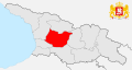
 Geo-imer-map.png 560 × 300; 14 KB
-
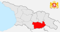
 Georgia Kvemo Kartli map.png 560 × 300; 14 KB
-
 GuriaLocationinGeorgia.svg 774 × 413; 716 KB
-
 ImeretiLocationinGeorgia.svg 774 × 413; 716 KB
-
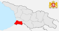
 KakhetiLocationinGeorgia.svg 774 × 413; 716 KB
-
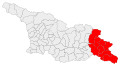 Kakhetis mkhare.svg 833 × 456; 2.09 MB
-
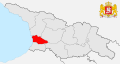
 KvemoKartliLocationinGeorgia.svg 774 × 413; 716 KB
-
 MtskhetaMtianetiLocationinGeorgia.svg 774 × 413; 716 KB
-
 Postal codes of Georgia.png 800 × 448; 128 KB
-
 RachaLocationinGeorgia.svg 774 × 413; 716 KB
-
 SamegreloZemoSvanetiLocationinGeorgia.svg 774 × 413; 716 KB
-
 SamtskheJavakhetiLocationinGeorgia.svg 774 × 413; 716 KB
-
 ShidaKartliLocationinGeorgia.svg 774 × 413; 716 KB


