Category:Maps of Zwickau
Jump to navigation
Jump to search
Media in category "Maps of Zwickau"
The following 15 files are in this category, out of 15 total.
-
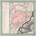 Grundriss Zwickau 1795.jpg 7,570 × 7,570; 15.61 MB
-
 Jeremias Vollrath Stadtplan Zwickau.jpg 825 × 550; 145 KB
-
 Meilenblatt B 131 Zwickau-Ausschnitt Zwickau.png 1,258 × 805; 2.2 MB
-
 Meilenblatt B 131 Zwickau.jpg 9,030 × 9,010; 28.8 MB
-
 Schwanenteichpark Zwickau Infotafel 02.jpg 4,000 × 3,000; 2.06 MB
-
 Schwanenteichpark Zwickau Infotafel 03.jpg 3,000 × 4,000; 2.12 MB
-
 Schwanenteichpark Zwickau Infotafel 04.jpg 3,000 × 4,000; 2.27 MB
-
 Section Zwickau.jpg 6,801 × 5,931; 12.69 MB
-
 Tränktor Zwickau, Infotafel (2).jpg 3,000 × 4,000; 2.07 MB
-
 Zwickau in German Democratic Republic.svg 618 × 789; 3 MB
-
 Zwickau in Z.svg 984 × 984; 482 KB
-
 Zwickau Parts of the Town.png 1,200 × 2,004; 679 KB
-
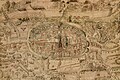
 Zwickau-1650-Merian.jpg 5,120 × 1,893; 2.41 MB
-
 Zwickau-Position.png 188 × 235; 5 KB
-


.jpg)


