<nowiki>Category:Maps of Zuidhorn; categoría de Wikimedia; kategori Wikimedia; Wikimedia category; د ويکيمېډيا وېشنيزه; Vikimedya kategorisi; ویکیمیڈیا زمرہ; kategória projektov Wikimedia; категорія проєкту Вікімедіа; 维基媒体分类; Wikimedia-Kategorie; Викимедиина категорија; kategorija na Wikimediji; विकिपीडिया:श्रेणी; page de catégorie de Wikimedia; kategorija na Wikimediji; विकिपीडिया वर्ग; категорија на Викимедији; Wikimedia-Kategorie; Wikimedia-kategori; kategori Wikimédia; تصنيف ويكيميديا; pajenn rummata eus Wikimedia; Wikimedia:ကဏ္ဍခွဲခြင်း; 維基媒體分類; Wikimedia категориясы; categoría de Wikimedia; Wikimedia-Kategorie; Викимедиа категорияһы; tudalen categori Wikimedia; kategori e Wikimedias; Վիքիմեդիայի նախագծի կատեգորիա; 维基媒体分类; Wikimedia-kategori; ვიკიპედია:კატეგორიზაცია; ウィキメディアのカテゴリ; categoria Wikimedia; تصنيف بتاع ويكيميديا; විකිමීඩියා ප්රභේද පිටුව; categoria Vicimediorum; विकिमीडिया श्रेणी; Wikimedia-luokka; Wikimedia category; guruhi Vikimedia; катэгорыя ў праекце Вікімэдыя; Викимедиа проектындагы төркем; catigurìa di nu pruggettu Wikimedia; หน้าหมวดหมู่วิกิมีเดีย; Wikimedia:Kategorija; Wikimedia-Kategorie; Wikimedia:Klassys; категория на Уикимедия; categorie a unui proiect Wikimedia; categurìa 'e nu pruggette Wikimedia; Wikimedia-kategori; kawan Wikimèdia; 維基媒體分類; 위키미디어 분류; Wikimedia-bólkur; kategorio en Vikimedio; kategori Wikimedia; Wikimedia:Ronnaghys; উইকিমিডিয়া বিষয়শ্রেণী; kategori Wikimedia; 维基媒体分类; וויקימעדיע קאַטעגאָריע; kategorija w projektach Wikimedije; thể loại Wikimedia; Wikimedia projekta kategorija; kategoria ti Wikimedia; categoria de um projeto da Wikimedia; Wikimedia category; категорияд Ангилал; Wikimedia-kategori; kategori Wikimedia; پۆلی ویکیمیدیا; Wikimedia category; Vikimédia ñemohenda; Wikimédia-kategória; વિકિપીડિયા શ્રેણી; Wikimediako kategoria; категория в проекте Викимедиа; Wikimedia-Kategorie; Kategoriya ning Wikimedia; Wikimedia-kategorie; Wîkîmediya:Kategorî; विकिमिडिया श्रेणी; Wikimedia-Kategorie; קטגוריה במיזמי ויקימדיה; Викимедиа проектындагы төркем; Wikimedia-categorie; विकिमिडिया श्रेणी; 维基媒体分类; Wikimedia-kategoriija; гурӯҳи Викимедиа; jamii ya Wikimedia; categoría de Wikimedia; Wikimedia-categorie; categoria di un progetto Wikimedia; катэгорыя ў праекце Вікімедыя; 维基媒体分类; 維基媒體分類; 維基媒體分類; Wikimedia-kategory; ردهٔ ویکیپدیا; Wikimedia proyektındağı törkem; гурӯҳи Викимедиа; ẹ̀ka Wikimedia; kategorie na projektech Wikimedia; categoria de um projeto da Wikimedia; Wikimedia-Kategorie; Vikipidiya:Shopni; tumbung Wikimedia; Wikimedia-kategorie; kategorija Wikimedie; kategorya ng Wikimedia; Wikimedia-Kategorie; விக்கிமீடியப் பகுப்பு; kategori Wikimedia; kategoria w projekcie Wikimedia; വിക്കിമീഡിയ വർഗ്ഗം; 維基媒體分類; kategori Wikimedia; Viciméid catagóir; زمرو:وڪيپيڊيا زمرا بندي; Wikimedia-categorie; categoría de Wikimedia; Wikimedia kategooria; κατηγορία εγχειρημάτων Wikimedia; categoria de Wikimedia</nowiki>
Subcategories
This category has the following 4 subcategories, out of 4 total.


.svg)

 BAG woonplaatsen - Gemeente Zuidhorn.png 2,419 × 2,419; 685 KB
 LocatieZuidhorn.png 280 × 130; 9 KB
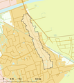 Rijksbeschermd stads- of dorpsgezicht - Zuidhorn - De Gast.png 2,016 × 2,267; 152 KB
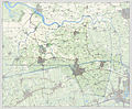 2013-Zuidhorn.jpg 3,318 × 2,734; 4.92 MB
 Bonnekaart - De Vereeniging (Grijpskerk).PNG 554 × 393; 500 KB
 Gem-Zuidhorn-2014Q1.jpg 6,569 × 5,465; 13.36 MB
 Gem-Zuidhorn-OpenTopo.jpg 8,057 × 6,481; 6.99 MB
 GemZuidhorn1866.gif 1,300 × 1,655; 181 KB
 LocatieHomsterland.png 185 × 176; 9 KB
 Map - NL - Zuidhorn (2009).svg 625 × 575; 1.81 MB
 Middag-Humsterland.jpg 483 × 601; 139 KB
 Streetplan of Grijpskerk.png 781 × 692; 94 KB
 TMK1864 - Ruigezandsterpolder.PNG 855 × 699; 705 KB
 TMK1864 - Waardsterpolder.PNG 896 × 682; 682 KB


.PNG)


.svg)


