Category:Maps of York
Jump to navigation
Jump to search
| Upload media | |||||
| |||||
Media in category "Maps of York"
The following 49 files are in this category, out of 49 total.
-
23.4.16 1 York 16 (26020130894).jpg 6,016 × 4,000; 6.35 MB
-
23.4.16 1 York 20 (26020221654).jpg 6,016 × 4,000; 8.1 MB
-
Location map United Kingdom York Central.png 2,374 × 1,683; 3.91 MB
-
Locationoffossriverbarrierwithprotectedzone.png 640 × 480; 206 KB
-
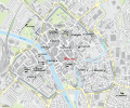
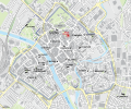
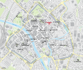
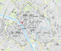
Map of medieval parish churches of York - All Saints, North Street.svg 1,086 × 906; 1.39 MB
-
Map of medieval parish churches of York - All Saints, Pavement.svg 1,086 × 906; 1.42 MB
-
Map of medieval parish churches of York - Holy Trinity, Goodramgate.svg 1,086 × 906; 1.42 MB
-
Map of medieval parish churches of York - Holy Trinity, Micklegate.svg 1,086 × 906; 1.42 MB
-
Map of medieval parish churches of York - St Andrew, St Andrewgate.svg 1,086 × 906; 1.42 MB
-
Map of medieval parish churches of York - St Crux, Pavement.svg 1,086 × 906; 1.42 MB
-
Map of medieval parish churches of York - St Cuthbert, Peasholme Green.svg 1,086 × 906; 1.42 MB
-
Map of medieval parish churches of York - St Denys, Walmgate.svg 1,086 × 906; 1.42 MB
-
Map of medieval parish churches of York - St Helen, Stonegate.svg 1,086 × 906; 1.42 MB
-
Map of medieval parish churches of York - St John, Micklegate.svg 1,086 × 906; 1.42 MB
-
Map of medieval parish churches of York - St Lawrence, Lawrence Street.svg 1,086 × 906; 1.42 MB
-
Map of medieval parish churches of York - St Margaret, Walmgate.svg 1,086 × 906; 1.42 MB
-
Map of medieval parish churches of York - St Martin, Coney Street.svg 1,086 × 906; 1.42 MB
-
Map of medieval parish churches of York - St Martin-cum-Gregory, Micklegate.svg 1,086 × 906; 1.42 MB
-
Map of medieval parish churches of York - St Mary, Bishophill Junior.svg 1,086 × 906; 1.42 MB
-
Map of medieval parish churches of York - St Mary, Castlegate.svg 1,086 × 906; 1.42 MB
-
Map of medieval parish churches of York - St Michael, Spurriergate.svg 1,086 × 906; 1.42 MB
-
Map of medieval parish churches of York - St Michael-le-Belfrey, High Petergate.svg 1,086 × 906; 1.42 MB
-
Map of medieval parish churches of York - St Olave, Marygate.svg 1,086 × 906; 1.42 MB
-
Map of medieval parish churches of York - St Sampson, Church Street.svg 1,086 × 906; 1.42 MB
-
Map of medieval parish churches of York - St Saviour, St Saviourgate.svg 1,086 × 906; 1.42 MB
-
Map of medieval parish churches of York.svg 1,086 × 906; 1.39 MB
-
Map Whip-Ma-Whop-Ma-Gate.svg 1,086 × 906; 2.05 MB
-
Mapof barrier.png 691 × 864; 221 KB
-
Maprawcliffe.jpg 396 × 398; 66 KB
-
NCN Route 66 Beverley-York.png 2,200 × 1,100; 2.17 MB
-
OSBALDWICK 2.jpg 462 × 385; 106 KB
-
OSBALDWICK, YORK.jpg 479 × 380; 105 KB
-
OSM map of York UK 1.png 684 × 662; 209 KB
-
OSM map of York UK 2.png 672 × 627; 279 KB
-
RidsdalePanorma.jpg 1,200 × 560; 229 KB
-
Vale of York Map.jpg 1,805 × 1,460; 103 KB
-
York unparished area UK locator map.svg 1,376 × 1,345; 412 KB
-
ヨーク地方の地図-ポンテフラクト-.png 1,781 × 1,098; 281 KB
-
ヨーク地方の地図-地理-大地形.png 1,781 × 1,445; 366 KB
-
ヨーク地方の地図-地理-水系.png 1,781 × 1,445; 268 KB
-
ヨーク地方の地図-歴史-イングランド内戦.png 1,781 × 1,445; 201 KB
-
ヨーク地方の地図-歴史-キリスト教.png 1,781 × 1,445; 162 KB
-
ヨーク地方の地図-歴史-ノルマン・コンクエスト後の世界.png 1,781 × 1,445; 227 KB
-
ヨーク地方の地図-歴史-ハロルド2世の戦い.png 1,781 × 1,445; 214 KB
-
ヨーク地方の地図-歴史-ローマ時代.png 1,781 × 1,445; 257 KB
-
ヨーク地方の地図-歴史-交通.png 1,781 × 1,445; 419 KB
-
ヨーク地方の地図-歴史-先史時代.png 1,781 × 1,445; 163 KB
-
ヨーク地方の地図-歴史-産業革命.png 1,781 × 1,445; 259 KB
-
ヨーク地方の地図-歴史-薔薇戦争.png 1,781 × 1,445; 286 KB


