Category:Maps of Xuancheng
Jump to navigation
Jump to search
Media in category "Maps of Xuancheng"
The following 6 files are in this category, out of 6 total.
-
 Administrative Division Xuancheng.png 1,860 × 1,760; 270 KB
-
 Guangde County Highway Network Planning Map.jpg 9,366 × 13,252; 12.03 MB
-
 Location of Xuancheng Prefecture within Anhui (China).png 800 × 600; 83 KB
-
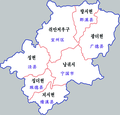 Xuancheng-map.png 700 × 672; 166 KB
-
 Xuancheng.png 1,200 × 1,341; 496 KB
-
 宣城市位置图.svg 1,001 × 1,302; 1.88 MB


.png)


