Category:Maps of Xanten
Jump to navigation
Jump to search
Wikimedia category | |||||
| Upload media | |||||
| Instance of | |||||
|---|---|---|---|---|---|
| Category combines topics | |||||
| Xanten | |||||
town in Wesel District, in North Rhine-Westphalia, Germany | |||||
| Instance of |
| ||||
| Location | Wesel, Düsseldorf Government Region, North Rhine-Westphalia, Germany | ||||
| Head of government |
| ||||
| Population |
| ||||
| Area |
| ||||
| Elevation above sea level |
| ||||
| official website | |||||
 | |||||
Media in category "Maps of Xanten"
The following 23 files are in this category, out of 23 total.
-
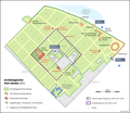
Archäologischer Park Xanten DE.png 1,960 × 1,700; 625 KB
-
Birten in Xanten.svg 461 × 649; 14 KB
-
Lage der Stadt Xanten in Deutschland.png 188 × 235; 5 KB
-
Lower Rhine Hill Ridge near Xanten.png 1,807 × 1,417; 526 KB
-
Lüttingen in Xanten.svg 461 × 649; 13 KB
-
Marienbaum in Xanten.svg 461 × 649; 14 KB
-
Parco archeologico di Xanten.png 637 × 490; 101 KB
-
Radrevier.ruhr Knotenpunkt 37 Fährhaus Xanten Karte.jpg 3,024 × 4,032; 2.9 MB
-
Radrevier.ruhr Knotenpunkt 42 Bf Xanten Karte.jpg 3,024 × 4,032; 2.89 MB
-
Verwaltungsgliederung Xanten.svg 461 × 649; 20 KB
-
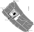
Vetera-it.png 1,153 × 1,578; 663 KB
-
Vetera.png 1,191 × 1,578; 550 KB
-
Vynen in Xanten.svg 461 × 649; 14 KB
-
Wardt in Xanten.svg 461 × 649; 14 KB
-
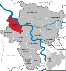
Xanten in WES.svg 451 × 483; 309 KB
-
Xanten in Xanten.svg 461 × 649; 14 KB
-
Xanten-Info Stadtplan.jpg 3,375 × 2,531; 1.59 MB
-
Xanten1500.PNG 610 × 572; 79 KB
-
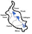
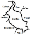
XantenBezirke.PNG 293 × 314; 47 KB
-
XantenBezirke.png 293 × 314; 46 KB
-
XantenNachbargemeinden.png 283 × 320; 30 KB
-
XN-Hees-Muna-Karte 01.jpg 2,709 × 2,107; 1.25 MB


