Category:Maps of Wyre Forest District
Jump to navigation
Jump to search
Media in category "Maps of Wyre Forest District"
The following 18 files are in this category, out of 18 total.
-
 WorcestershireWyreForest.png 200 × 176; 14 KB
-
 Wyre Forest (42993277272).png 2,164 × 1,572; 118 KB
-
 WYRE FOREST (49910218358).png 2,160 × 1,080; 394 KB
-
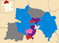
 Wyre Forest UK local election 2002 map.png 665 × 480; 52 KB
-
 Wyre Forest UK local election 2003 map.png 665 × 480; 51 KB
-
 Wyre Forest UK local election 2004 map.svg 1,425 × 1,043; 358 KB
-
 Wyre Forest UK local election 2006 map.svg 1,425 × 1,043; 356 KB
-
 Wyre Forest UK local election 2007 map.svg 1,425 × 1,043; 356 KB
-
 Wyre Forest UK local election 2008 map.svg 1,425 × 1,043; 356 KB
-
 Wyre Forest UK local election 2010 map.svg 1,425 × 1,043; 356 KB
-
 Wyre Forest UK local election 2011 map.svg 1,425 × 1,043; 356 KB
-
 Wyre Forest UK local election 2012 map.svg 1,425 × 1,043; 356 KB
-
 Wyre Forest UK local election 2014 map.svg 1,425 × 1,043; 356 KB
-
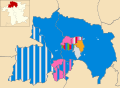 Wyre Forest UK local election 2019 map.svg 1,425 × 1,043; 438 KB
-
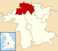 Wyre Forest UK locator map.svg 1,425 × 1,262; 892 KB
-
 Wyre Forest UK ward map 2010 (blank).svg 1,425 × 1,043; 356 KB
-
 Wyre Forest UK ward map 2015 (blank).svg 1,425 × 1,043; 432 KB
-
 Wyre Forest wards 2019.svg 1,425 × 1,043; 434 KB

.png)
.png)


.svg)
.svg)