Category:Maps of Wissous
Jump to navigation
Jump to search
Wikimedia category | |||||
| Upload media | |||||
| Instance of | |||||
|---|---|---|---|---|---|
| Category combines topics | |||||
| Wissous | |||||
commune in Essonne, France .jpg) .svg) _-_2022-05-30_-_1.jpg)  | |||||
| Pronunciation audio | |||||
| Instance of | |||||
| Location |
| ||||
| Head of government |
| ||||
| Population |
| ||||
| Area |
| ||||
| Elevation above sea level |
| ||||
| official website | |||||
 | |||||
Media in category "Maps of Wissous"
The following 32 files are in this category, out of 32 total.
-
 91 Communes Essonne Wissous.png 723 × 750; 166 KB
-
 91689-Wissous - Localisation.png 2,500 × 2,480; 1,017 KB
-
 91689-Wissous-cadastre.png 7,015 × 4,960; 13.1 MB
-
 91689-Wissous-géologie.png 7,015 × 4,960; 14.05 MB
-
 91689-Wissous-Hydro.jpeg 5,846 × 4,133; 3.73 MB
-
 91689-Wissous-Hydro.png 7,015 × 4,960; 13.54 MB
-
 91689-Wissous-Natura 2000.png 7,015 × 4,960; 7.29 MB
-
 91689-Wissous-Orthophoto.png 7,015 × 4,960; 6.62 MB
-
 91689-Wissous-sols.png 7,015 × 4,960; 13.49 MB
-
 91689-Wissous-Sols.png 3,270 × 2,598; 5.42 MB
-
 91689-Wissous-ZNIEFF1.png 7,015 × 4,960; 7.38 MB
-
 91689-Wissous-ZNIEFF2.png 7,015 × 4,960; 7.38 MB
-
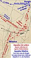 Aqueduc de Lutèce Bassin collecteur et rigoles d'alimentation.jpg 280 × 523; 51 KB
-
 Carte d'Etat Major.1866.Wissous.png 576 × 705; 1,001 KB
-
 Domaine de Montjean (OSM).png 768 × 637; 288 KB
-
 Espace Arthur-Clark (OSM).png 536 × 756; 186 KB
-
 Localisation Wissous.png 400 × 400; 79 KB
-
 Map commune FR insee code 91689.png 756 × 605; 86 KB
-
 Massy Antony Wissous - Carte d'État-major de la France 1866.png 1,483 × 839; 2.13 MB
-
 Plan de l'Acqueduc Romain de Lutèce..ark 73873 pf0000855509 v0001.jpg 5,801 × 929; 648 KB
-
 Plan de l'aqueduc romain de Lutèce (détail sur Wissous).jpg 1,234 × 562; 515 KB
-
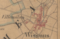 Wissous - Carte d'État-major de la France 1866.png 830 × 538; 935 KB
-
 Wissous - centre-ville (OSM, 2020).png 672 × 638; 233 KB
-
 Wissous - Château Gaillard (OSM, 2020).png 729 × 523; 239 KB
-
 Wissous - Domaine de Montjean (OSM, 2020).png 802 × 694; 421 KB
-
 Wissous - Espace Arthur Clark (OSM, 2020).png 523 × 809; 250 KB
-
 Wissous - Espace Marcel Dassault (OSM, 2020).png 560 × 813; 189 KB
-
 Wissous - PIC et TNT (OSM, 2020).png 932 × 788; 386 KB
-
 Wissous - vue générale (OSM, 2020).png 871 × 737; 796 KB
-
 Wissous Limite communale.jpg 959 × 576; 246 KB
-
 Wissous OpenStreetMap.svg 1,141 × 1,106; 950 KB
-
 Wissous par Cassini.png 751 × 438; 186 KB


.png)
.png)


.jpg)

.png)
.png)
.png)
.png)
.png)
.png)
.png)


