Category:Maps of Willemstad, Curaçao
Jump to navigation
Jump to search
Media in category "Maps of Willemstad, Curaçao"
The following 15 files are in this category, out of 15 total.
-
 Burmannia - Pietermaai 1751.png 2,490 × 1,130; 5.1 MB
-
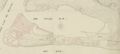
 Curaçao Stadsdistrict Willemstad 1836 - Pietermaai.png 328 × 175; 119 KB
-
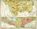
 Encyclopaedie van Nederlandsch West-Indië-Surinam north-Benj004ency01ill stitched.jpg 3,987 × 5,378; 31.32 MB
-
 Encyclopaedie van Nederlandsch West-Indië-Surinam south-Benj004ency01ill03.gif 4,035 × 3,215; 5.56 MB
-

-
 Item 53113.jpg 600 × 415; 32 KB
-
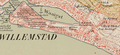 Pietermaai 1911.png 834 × 380; 709 KB
-
 S. Geerts - Pietermaai 1754.png 1,366 × 691; 1.61 MB
-
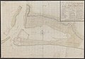
 S. Geerts - Plan van een gedeelte van de Willemstad en het fort Amsterdam (1754).jpg 10,000 × 5,076; 35.9 MB
-
 Topographische kaart van Curaçao 1911 blad XII.jpg 3,908 × 3,838; 2.93 MB
-
 Waaigat (1911).jpg 1,084 × 640; 303 KB
-
 Werbata - kaart van het stadsdistrict van Curaçao.jpg 2,772 × 1,395; 1.12 MB
-
 Werbata - Pietermaai.png 683 × 310; 398 KB
-
 Wilemstad-map-open-he.png 688 × 731; 213 KB
-
 Willemstad.JPG 1,348 × 957; 751 KB


.jpg)


.jpg)

.jpg)


