Category:Maps of Weymouth, Dorset
Jump to navigation
Jump to search
Media in category "Maps of Weymouth, Dorset"
The following 14 files are in this category, out of 14 total.
-

-
 Ordnance Survey Drawings - Weymouth (OSD 56).jpg 4,000 × 2,032; 2.41 MB
-
 2012 olympic sailing areas BASE.png 1,920 × 1,080; 5.94 MB
-
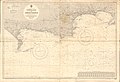
 Admiralty Chart No 2255 Weymouth and Portland, Published 1945.jpg 11,033 × 16,156; 46.85 MB
-
 Admiralty Chart No 2268 Portland Harbour, Published 1951.jpg 11,143 × 16,196; 55.72 MB
-
 Admiralty Chart No 2610 Portland to St. Albans Head, Published 1969.jpg 18,378 × 11,217; 47.47 MB
-
 Admiralty Chart No 2615 Portland to Christchurch, Published 1954.jpg 16,379 × 11,256; 13.62 MB
-
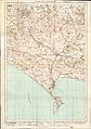
 Ordnance Survey Half-inch Sheet 37 Weymouth Yeovil & Taunton, Published 1915.jpg 12,137 × 9,758; 13.75 MB
-
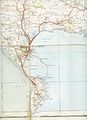
 Ordnance Survey One-Inch Sheet 140 Weymouth & Dorchester, Published 1919.jpg 8,511 × 12,098; 9.63 MB
-
 Ordnance Survey One-Inch Sheet 178 Dorchester, Published 1945.jpg 8,196 × 9,562; 11.16 MB
-
 Ordnance Survey One-Inch Sheet 178 Dorchester, Published 1960.jpg 8,580 × 10,678; 19.11 MB
-
 Ordnance Survey One-Inch Sheet 178 Dorchester, Published 1970.jpg 11,068 × 13,196; 58.61 MB
-
 Weymouth - Dorset dot.png 1,802 × 2,589; 189 KB
-
 Weymouthmap 1937.jpg 2,544 × 3,504; 1.33 MB
.jpg)
.jpg)


