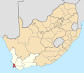
Category:Maps of Western Cape municipalities with 2016 borders
Jump to navigation
Jump to search
This category contains maps of municipalities in the Western Cape province of South Africa that show the the municipal borders as they are after the municipal election of 3 August 2016. This is the most recent demarcation.
Media in category "Maps of Western Cape municipalities with 2016 borders"
The following 43 files are in this category, out of 43 total.
-
Map of the Western Cape with districts labelled (2016).svg 849 × 676; 530 KB
-
Map of the Western Cape with municipalities blank (2016).svg 849 × 676; 902 KB
-
Map of the Western Cape with municipalities labelled (2016).svg 849 × 676; 679 KB
-
Map of the Western Cape with Beaufort West highlighted (2016).svg 849 × 676; 472 KB
-
Map of the Western Cape with Bergrivier highlighted (2016).svg 849 × 676; 469 KB
-
Map of the Western Cape with Bitou highlighted (2016).svg 849 × 676; 463 KB
-
Blank map of the Western Cape (2016).svg 805 × 621; 436 KB
-
Map of the Western Cape with Breede Valley highlighted (2016).svg 849 × 676; 461 KB
-
Map of the Western Cape with Cape Agulhas highlighted (2016).svg 849 × 676; 470 KB
-
Map of South Africa with Cape Town highlighted (2016).svg 809 × 709; 716 KB
-
Map of the Western Cape with Cape Town highlighted (2016).svg 849 × 676; 478 KB
-
Map of South Africa with Cape Winelands highlighted (2016).svg 809 × 709; 719 KB
-
Map of the Western Cape with Cape Winelands highlighted (2016).svg 849 × 676; 477 KB
-
Map of the Western Cape with Cederberg highlighted (2016).svg 849 × 676; 471 KB
-
Map of South Africa with Central Karoo highlighted (2016).svg 809 × 709; 720 KB
-
Map of the Western Cape with Central Karoo highlighted (2016).svg 849 × 676; 475 KB
-
Map of the Western Cape with Drakenstein highlighted (2016).svg 849 × 676; 465 KB
-
Map of South Africa with Garden Route highlighted (2016).svg 809 × 709; 722 KB
-
Map of the Western Cape with Garden Route highlighted (2016).svg 849 × 676; 490 KB
-
Map of the Western Cape with George highlighted (2016).svg 849 × 676; 466 KB
-
Map of the Western Cape with Hessequa highlighted (2016).svg 849 × 676; 477 KB
-
Kaart van Wes-Kaap munisipaliteite (2016).svg 849 × 676; 676 KB
-
Map of the Western Cape with Kannaland highlighted (2016).svg 849 × 676; 463 KB
-
Map of the Western Cape with Knysna highlighted (2016).svg 849 × 676; 461 KB
-
Map of the Western Cape with Laingsburg highlighted (2016).svg 849 × 676; 467 KB
-
Map of the Western Cape with Langeberg highlighted (2016).svg 849 × 676; 462 KB
-
Map of the Western Cape with Matzikama highlighted (2016).svg 849 × 676; 478 KB
-
Map of the Western Cape with Mossel Bay highlighted (2016).svg 849 × 676; 470 KB
-
Map of the Western Cape with Oudtshoorn highlighted (2016).svg 849 × 676; 464 KB
-
Map of South Africa with Overberg highlighted (2016).svg 809 × 709; 721 KB
-
Map of the Western Cape with Overberg highlighted (2016).svg 849 × 676; 488 KB
-
Map of the Western Cape with Overstrand highlighted (2016).svg 849 × 676; 471 KB
-
Map of the Western Cape with Prince Albert highlighted (2016).svg 849 × 676; 462 KB
-
Map of the Western Cape with Saldanha Bay highlighted (2016).svg 849 × 676; 475 KB
-
Map of the Western Cape with Stellenbosch highlighted (2016).svg 849 × 676; 462 KB
-
Map of the Western Cape with Swartland highlighted (2016).svg 849 × 676; 472 KB
-
Map of the Western Cape with Swellendam highlighted (2016).svg 849 × 676; 469 KB
-
Map of the Western Cape with Theewaterskloof highlighted (2016).svg 849 × 676; 462 KB
-
Map of South Africa with West Coast highlighted (2016).svg 809 × 709; 731 KB
-
Map of the Western Cape with West Coast highlighted (2016).svg 849 × 676; 509 KB
-
Map of the Western Cape with Witzenberg highlighted (2016).svg 849 × 676; 466 KB


