Category:Maps of Westchester County, New York (style A)
Jump to navigation
Jump to search
Media in category "Maps of Westchester County, New York (style A)"
The following 40 files are in this category, out of 40 total.
-
Ardsley.PNG 650 × 781; 56 KB
-
Bedford.PNG 650 × 781; 56 KB
-
Briarcliff-Westchester.svg 1,249 × 801; 127 KB
-
BriarcliffManor.PNG 650 × 781; 56 KB
-
Bronxville.PNG 689 × 795; 58 KB
-
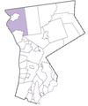
Cortlandt.PNG 650 × 781; 56 KB
-
CrotonOnHudson.PNG 650 × 781; 56 KB
-
DobbsFerry.PNG 650 × 781; 56 KB
-
Eastchester.PNG 681 × 788; 57 KB
-
Elmsford.PNG 650 × 781; 56 KB
-
Greenburgh.PNG 650 × 781; 56 KB
-
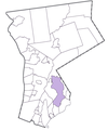
Harrison.PNG 650 × 781; 57 KB
-
HastingsOnHudson.PNG 650 × 781; 56 KB
-
Irvington.PNG 650 × 781; 56 KB
-
Larchmont.PNG 668 × 781; 57 KB
-
Lewisboro.PNG 650 × 781; 56 KB
-
MamaroneckTown.PNG 668 × 781; 57 KB
-
MamaroneckVillage.PNG 677 × 782; 57 KB
-
Map of Westchester County, NY, highlighting city of Rye.png 699 × 790; 58 KB
-
MountKisco.PNG 650 × 781; 56 KB
-
MountPleasant.PNG 650 × 781; 56 KB
-
MountVernon.PNG 673 × 774; 57 KB
-
NewCastle.PNG 650 × 781; 56 KB
-
NewRochelle.PNG 650 × 781; 56 KB
-
NorthCastle.PNG 650 × 781; 56 KB
-
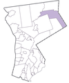
NorthSalem.PNG 650 × 781; 56 KB
-
Ossining.PNG 650 × 781; 56 KB
-
Peekskill.PNG 650 × 781; 56 KB
-
Pelham.PNG 680 × 790; 57 KB
-
PelhamManor.PNG 676 × 791; 57 KB
-
Pleasantville.PNG 650 × 781; 56 KB
-
Portchester.PNG 650 × 781; 56 KB
-
PoundRidge.PNG 650 × 781; 56 KB
-
RyeBrook.PNG 650 × 781; 56 KB
-
Scarsdale.PNG 650 × 781; 56 KB
-
SleepyHollow.PNG 650 × 781; 56 KB
-
Tarrytown.PNG 650 × 781; 56 KB
-
Tuckahoe.PNG 676 × 799; 57 KB
-
Yonkers.PNG 685 × 790; 58 KB
-
Yorktown.PNG 650 × 781; 57 KB
