Category:Maps of Weser
Jump to navigation
Jump to search
Subcategories
This category has the following 3 subcategories, out of 3 total.
Media in category "Maps of Weser"
The following 66 files are in this category, out of 66 total.
-
 Urbis Bremae Territorium - Dilich-Chronik - 1603.jpg 1,191 × 1,762; 3.55 MB
-
 Weser Einzugsgebiet+Nr.png 791 × 886; 189 KB
-
 Weser Einzugsgebiet.png 791 × 886; 594 KB
-
 Bremen mit Vegesack 1648 1686.jpg 1,018 × 719; 754 KB
-
 Bremen mit Vegesack 1648.png 1,741 × 1,173; 1.49 MB
-
 Unterweser Jadebusen 1643-48.jpg 7,518 × 3,132; 12.45 MB
-

-
 Vegesacker Hafen - Grundriss 1766.png 2,419 × 3,899; 2.58 MB
-
 28 of 'Geschichte des Jeverlands' (11238789505).jpg 1,506 × 2,415; 694 KB
-

-
 A Weser watershed closer.gif 370 × 563; 9 KB
-
 Admiralty Chart No 1875 Jade River to Norder Piep, Published 1934.jpg 16,496 × 11,267; 53.75 MB
-
 Admiralty Chart No 3346 Jade River and Weser River Entrances, Published 1914, Large Corrections 1940.jpg 11,347 × 22,194; 41.56 MB
-
 Admiralty Chart No 3346 North Sea Jade and Weser Rivers, Published 1904.jpg 8,361 × 13,979; 20.35 MB
-
 Admiralty Chart No 3347 Helgoland Bight and approaches, Published 1919.jpg 11,130 × 16,241; 45.9 MB
-
 Admiralty Chart No 3506 Weser River Hohe Weg Light to Bremen, Published 1914.jpg 11,102 × 16,248; 69.95 MB
-
 Bassin de la Weser.png 565 × 568; 336 KB
-
 Blexer Weserstein.jpg 2,736 × 3,648; 3.66 MB
-
 Bremen (Ausschnitt) - C. A. Heineken - 1806.jpg 2,362 × 1,662; 3.71 MB
-
 Bremer Staatsgebiet seit 1800.png 656 × 1,056; 33 KB
-
 Bremerhaven - 1831.jpg 961 × 595; 483 KB
-
 Carlsburg - Erik Dahlberg - 1681.jpg 842 × 639; 339 KB
-
 Carlsburg - Jean Mell - 1695.jpg 842 × 600; 912 KB
-

-
 De Nordseeküste (Karten) 05.jpg 6,182 × 4,412; 3.88 MB
-
 De Nordseeküste (Karten) 06.jpg 6,472 × 4,352; 3.42 MB
-
 DVB-T-Karte Reinhardshagen.png 1,613 × 2,521; 78 KB
-

-
 Elbe weser mündung.jpg 4,572 × 3,956; 6.37 MB
-
 Fluss Weser in Deutschland.PNG 1,414 × 1,929; 1.95 MB
-
 Franzius Unterweser r90.jpg 2,160 × 1,407; 2.23 MB
-
 Franzius Unterweser.jpg 2,160 × 1,407; 2.36 MB
-
 Hannoversche Klippen.svg 744 × 1,052; 31 KB
-
 Jade-weser-muendung map de.png 800 × 743; 415 KB
-
 Jade-weser-muendung map de.svg 1,483 × 1,377; 617 KB
-
 Jadebusen mit Weser 9103.jpg 4,491 × 2,288; 2.08 MB
-

-
 Karte Hannoversche Klippen.png 1,797 × 1,307; 460 KB
-
 Karte jadebusen.jpg 1,200 × 971; 179 KB
-
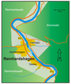 Karte neu Reinhardshagen.png 2,568 × 3,023; 584 KB
-
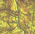
 Karte Reinhardshagen 1841.jpg 1,800 × 1,283; 1.08 MB
-
 Karte Reinhardshagen 1905.png 709 × 694; 1.29 MB
-
 Karte Weserverlauf.png 2,664 × 3,302; 571 KB
-
 Karte Weserverlauf1.jpg 2,664 × 3,302; 654 KB
-
 Karte zu den Grenzstreitigkeiten zwischen den Ämtern Sternberg und Schaumburg.tif 10,858 × 3,802; 118.39 MB
-
 Karte2003-kopie.tif 2,052 × 1,246; 798 KB
-
 Kurhann Landesaufn Bl 20 2012-07-21.jpg 2,392 × 1,834; 503 KB
-
 Wesersände Kurhannoversche Landesaufnahme 1773.png 1,336 × 1,973; 4.09 MB
-
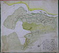
 Map of the estuary of the Weser River (clipping) - 1685.jpg 842 × 636; 852 KB
-
 MapWezer-1926-1023.jpg 8,748 × 11,966; 17.71 MB
-
 OldenburgerDeiche um1645+Lockfleth um1515.jpg 1,896 × 1,708; 2.37 MB
-
 Radarkette Weser.jpg 2,225 × 2,803; 460 KB
-
 Siege of Carlsburg 1676 (Print).jpg 874 × 1,134; 821 KB
-
 Siege of Carlsburg 1676.jpg 842 × 455; 304 KB
-
 JadeWeser.png 3,365 × 3,231; 655 KB
-
 Vegesack - Hammelwarden Franzius.png 2,171 × 1,372; 3.35 MB
-
 Visurgis ab inclyta Brema ad ostium maris 1648 1653 1686.jpg 5,150 × 1,885; 8.14 MB
-
 Wallburgen im Weserbogen.jpg 987 × 621; 105 KB
-
 Water divide Rhine Weser.png 937 × 791; 204 KB
-
 Weser 1805 Blatt I von Bremen bis Oslebshausen.png 2,260 × 1,976; 4.07 MB
-
 Weser 1805 Blatt II von Oslebshausen bis Mohrlosenkirchen.png 2,320 × 1,980; 4.49 MB
-
 Weser 1805 Blatt III von Moorlosenkirche bis Fährgrund.png 2,432 × 1,962; 4.06 MB
-
 Weser basin topo.png 2,544 × 4,260; 14.31 MB
-
 Weser Flusssystem topo.png 2,544 × 4,260; 14.22 MB
-
 Weser watershed 3.png 514 × 641; 19 KB
-
 Weserprofil.png 780 × 703; 131 KB


.jpg)


_-_C._A._Heineken_-_1806.jpg)


_05.jpg)
_06.jpg)

_et_la_Lenne_(Leine)._Cours_du_Wesser_depuis_M%C3%BCnden_hannovrien_jusqu%27au_dessus_d%27Hamelen_(Hameln),_o%C3%B9_sont_marqu%C3%A9s_les_gu%C3%A9s_et_passages_-_btv1b530646121.jpg)


,_RP-P-2018-1076.jpg)


_-_1685.jpg)


.jpg)


