Category:Maps of Warwick District
Jump to navigation
Jump to search
Media in category "Maps of Warwick District"
The following 12 files are in this category, out of 12 total.
-
 Map of Gas Works Warwick, 1851.jpg 2,723 × 2,843; 2.07 MB
-
 WARWICK (49910737771).png 2,160 × 1,080; 309 KB
-
 Warwick UK local election 2010 map.svg 1,425 × 1,140; 370 KB
-
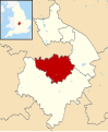 Warwick UK locator map.svg 1,042 × 1,266; 911 KB
-
 Warwick UK ward map 2007.svg 1,229 × 941; 255 KB
-
 Warwick UK ward map 2010 (blank).svg 1,425 × 1,140; 370 KB
-
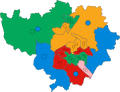
 Warwick UK ward map 2011.svg 1,229 × 941; 253 KB
-
 Warwick UK ward map 2015 (blank).svg 1,425 × 1,140; 539 KB
-
 Warwick UK ward map 2015.svg 1,152 × 882; 424 KB
-
 Warwick UK ward map 2019.svg 700 × 536; 195 KB
-
 Warwick UK ward map 2023.svg 700 × 536; 196 KB
-
 WarwickshireWarwick.png 200 × 306; 19 KB

.png)


.svg)
.svg)