Category:Maps of Warren County, Indiana from 1877 atlas
Jump to navigation
Jump to search
Media in category "Maps of Warren County, Indiana from 1877 atlas"
The following 12 files are in this category, out of 12 total.
-
Green Hill Indiana map from 1877 atlas.png 1,024 × 1,011; 2.18 MB
-
Independence Indiana map from 1877 atlas.png 1,024 × 802; 1.8 MB
-
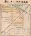
Johnsonville Indiana map from 1877 atlas.png 1,280 × 1,491; 3.06 MB
-
Marshfield Indiana map from 1877 atlas.png 1,280 × 1,556; 3 MB
-
Pike Township, Warren County, Indiana map from 1877 atlas.png 1,473 × 2,048; 5.29 MB
-
Pine Village Indiana map from 1877 atlas.png 871 × 1,024; 1.86 MB
-
Rainsville Indiana map from 1877 atlas.png 717 × 1,024; 1.62 MB
-
State Line City Indiana map from 1877 atlas.png 1,632 × 1,330; 3.74 MB
-
Warren County, Indiana map from 1877 atlas.png 1,698 × 2,048; 6.62 MB
-
Washington Township, Warren County, Indiana map from 1877 atlas.png 2,048 × 1,655; 6.52 MB
-
West Lebanon, Indiana map from 1877 atlas.png 948 × 1,863; 2.73 MB
-
Williamsport, Indiana map from 1877 atlas.png 1,665 × 2,048; 6.72 MB


