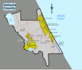
Category:Maps of Volusia County, Florida
Jump to navigation
Jump to search
Counties of Florida: Alachua · Baker · Bay · Bradford · Brevard · Broward · Calhoun · Charlotte · Citrus · Clay · Collier · Columbia · DeSoto · Dixie · Duval · Escambia · Flagler · Franklin · Gadsden · Gilchrist · Glades · Gulf · Hamilton · Hardee · Hendry · Hernando · Highlands · Hillsborough · Holmes · Indian River · Jackson · Jefferson · Lafayette · Lake · Lee · Leon · Levy · Liberty · Madison · Manatee · Marion · Martin · Miami-Dade · Monroe · Nassau · Okaloosa · Okeechobee · Orange · Osceola · Palm Beach · Pasco · Pinellas · Polk · Putnam · Santa Rosa · Sarasota · Seminole · St. Johns · St. Lucie · Sumter · Suwannee · Taylor · Union · Volusia · Wakulla · Walton · Washington
Wikimedia category | |||||
| Upload media | |||||
| Instance of | |||||
|---|---|---|---|---|---|
| Category combines topics | |||||
| Volusia County | |||||
county in Florida, United States of America | |||||
| Instance of | |||||
| Location | Florida | ||||
| Located in or next to body of water | |||||
| Capital | |||||
| Inception |
| ||||
| Population |
| ||||
| Area |
| ||||
| official website | |||||
 | |||||
Subcategories
This category has the following 2 subcategories, out of 2 total.
Media in category "Maps of Volusia County, Florida"
The following 13 files are in this category, out of 13 total.
-
Bird's eye view of De Land, Fla., Volusia County, 1884 LOC 89692606.jpg 7,093 × 4,676; 4.37 MB
-
Bird's eye view of De Land, Fla., Volusia County, 1884 LOC 89692606.tif 7,093 × 4,676; 94.89 MB
-
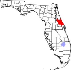
Map of Florida highlighting Volusia County.svg 1,130 × 1,126; 179 KB
-
Port Orange.gif 575 × 425; 28 KB
-
Spanish Land Grant Papers of John B. Gaudry page 8 of 53.png 991 × 1,557; 3.28 MB
-
Volusia County Florida.png 300 × 295; 10 KB
-
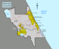
Volusia County static map.png 7,127 × 6,022; 1.69 MB
-
Volusia County static map.svg 953 × 805; 85 KB


