Category:Maps of Volos
Jump to navigation
Jump to search
Media in category "Maps of Volos"
The following 38 files are in this category, out of 38 total.
-
 - Peeters Jacob (2) - 1690.jpg 1,500 × 1,045; 902 KB
-
 Pianta della Fort Di Volo - Coronelli Vincenzo - 1687.jpg 800 × 618; 262 KB
-
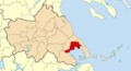
 2010 Dimos Volou.svg 1,741 × 844; 72 KB
-
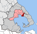
 2011 Dimos Volou.png 1,600 × 873; 241 KB
-
 Admiralty Chart No 1085 Kolpos Petalion to Strimonokos Kolpos, Published 1962.jpg 11,252 × 18,438; 43.75 MB
-
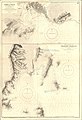 Admiralty Chart No 1196 Port of Volo and Skiathos Harbour, Published 1888, Large Corrections to 1928.jpg 11,075 × 16,239; 40.82 MB
-

-

-
 Antonios Karambetsos Volos (Greece) city plan c1907.jpg 2,662 × 1,859; 2.1 MB
-
 DE Agrias.svg 702 × 659; 687 KB
-
 DE Artemidas.svg 702 × 659; 687 KB
-
 DE Esonias.svg 702 × 659; 687 KB
-
 DE Iolkou.svg 702 × 659; 687 KB
-
 DE Makrinitsis.svg 702 × 659; 687 KB
-
 DE Neas Anchialou.svg 702 × 659; 687 KB
-
 DE Neas Ionias.svg 702 × 659; 687 KB
-
 DE Portarias.svg 702 × 659; 687 KB
-
 DE Volou.svg 702 × 659; 687 KB
-
 Dimos Agrias.png 400 × 252; 32 KB
-
 Dimos Artemidos.png 400 × 252; 32 KB
-
 Dimos Esonias.png 400 × 252; 32 KB
-
 Dimos Iolkou.png 400 × 252; 32 KB
-
 Dimos Neas Aghialou.png 400 × 252; 32 KB
-
 Dimos Neas Ionias.png 400 × 252; 32 KB
-
 Dimos Portarias.png 400 × 252; 32 KB
-
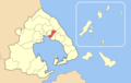
 Dimos Volou Enotites.png 723 × 486; 53 KB
-
 Dimos Volou.png 400 × 252; 32 KB
-
 Griechenland BV042747433.jpg 5,924 × 5,419; 3.36 MB
-
 Kaart Griekenland Volos.png 328 × 351; 17 KB
-
 Koinotita Makrinitsis.png 400 × 252; 32 KB
-
 Neamap1.jpg 644 × 332; 42 KB
-
 Plan de Volo 1915.jpg 6,256 × 6,048; 7.83 MB
-

-
 Volos city map - 1944.jpg 15,370 × 20,520; 80.08 MB
-
 Volos city map 1905.png 2,481 × 1,775; 6.51 MB
-
 Volos city map.png 1,538 × 1,138; 1.48 MB
-
 Volos map - 1944.jpg 12,397 × 15,370; 6.64 MB
-
 Volos map.png 200 × 204; 9 KB
_-_1690.jpg)


_with_Oreos_and_Talanta_Channels,_Published_1890.jpg)
_city_plan_c1907.jpg)


_cropped_from_Admiralty_Chart_No_1196_Port_of_Volo_and_Skiathos_Harbour,_Published_1888,_Large_Corrections_to_1928.jpg)


