Category:Maps of Viqueque
Jump to navigation
Jump to search
Media in category "Maps of Viqueque"
The following 68 files are in this category, out of 68 total.
-
 2015 East Timor Viqueque locator map.png 3,344 × 1,929; 177 KB
-
 2015 Viqueque beschriftet.png 4,671 × 2,521; 1.06 MB
-
 Administrative map of the Viqueque district of East Timor.png 2,600 × 1,531; 429 KB
-
 Afaloicai (Uato-Lari) suco.png 3,111 × 2,170; 3.37 MB
-
 Afaloicai (Uatucarbau) suco.png 3,119 × 2,170; 2.51 MB
-
 Ahic suco.png 3,115 × 2,161; 3.9 MB
-
 Babulo (Uato-Lari) suco.png 3,109 × 2,170; 2.07 MB
-
 Bahalarauain suco.png 3,115 × 2,170; 4.24 MB
-
 Bahatata suco.png 3,109 × 2,170; 2.28 MB
-
 Bibileo suco.png 3,109 × 2,170; 3.1 MB
-
 Builale suco.png 3,119 × 2,161; 2.14 MB
-
 Builo (Ossu) suco.png 3,109 × 2,161; 1.6 MB
-
 Caraubalo suco.png 3,117 × 2,170; 3.8 MB
-
 Dilor suco.png 3,109 × 2,162; 1.78 MB
-
 Division of Macadique 2023.png 1,984 × 1,948; 1.86 MB
-
 East Timor Viqueque locator map 2003-2015.svg 1,607 × 710; 126 KB
-
 East Timor-Viqueque.png 3,180 × 1,476; 438 KB
-
 Fatudere suco.png 3,109 × 2,170; 1.9 MB
-
 Irabin de Baixo suco.png 3,115 × 2,170; 1.79 MB
-
 Irabin de Cima suco.png 3,109 × 2,170; 2.29 MB
-
 Lacluta pa.png 3,115 × 2,161; 2.22 MB
-
 Laline suco.png 3,119 × 2,162; 3.55 MB
-
 Liaruca suco.png 3,083 × 2,132; 2.61 MB
-
 Loi Ulo suco.png 3,123 × 2,166; 1.94 MB
-
 Loi-Huno suco.png 3,109 × 2,161; 2.02 MB
-
 Luca (Viqueque) suco.png 3,111 × 2,166; 2.89 MB
-
 Macadique suco.png 3,113 × 2,167; 5.12 MB
-
 Maluru suco.png 3,109 × 2,162; 2.08 MB
-
 Map of Timor-Leste - administrative (since 2015) - Município of Viqueque.png 4,671 × 2,521; 644 KB
-
 Matahoi suco.png 3,109 × 2,170; 3.92 MB
-
 Nahareca suco.png 3,119 × 2,161; 4.03 MB
-
 Ossorua suco.png 3,109 × 2,161; 3.05 MB
-
 Ossu de Cima suco.png 3,115 × 2,160; 2.56 MB
-
 Ossu pa.png 3,124 × 2,161; 2.58 MB
-
 Rain 2000 LACLUTA.jpg 968 × 968; 170 KB
-
 Rain 2000 OSSU.jpg 968 × 968; 181 KB
-
 Rain 2000 UATO-LARI.jpg 968 × 968; 131 KB
-
 Rain 2000 UATUCARBAU.jpg 968 × 968; 107 KB
-
 Rain 2000 VIQUEQUE.jpg 968 × 968; 214 KB
-
 Rio Dilor.png 110 × 216; 15 KB
-
 Sucos Viqueque.png 2,600 × 1,531; 578 KB
-
 Temperature 2000 LACLUTA.jpg 968 × 968; 161 KB
-
 Temperature 2000 OSSU.jpg 968 × 968; 172 KB
-
 Temperature 2000 UATO-LARI.jpg 968 × 968; 126 KB
-
 Temperature 2000 UATUCARBAU.jpg 968 × 968; 103 KB
-
 Temperature 2000 VIQUEQUE.jpg 968 × 968; 208 KB
-
 Uabubo suco.png 3,109 × 2,161; 4.42 MB
-
 Uaguia suco.png 3,115 × 2,160; 2.05 MB
-
 Uai-Mori suco.png 3,111 × 2,161; 4.5 MB
-
 Uaibobo suco.png 3,109 × 2,161; 3.87 MB
-
 Uaitame (Uato-Lari) suco.png 3,115 × 2,165; 2.58 MB
-
 Uani Uma suco.png 3,109 × 2,162; 1.79 MB
-
 Uato-Lari pa.png 3,107 × 2,158; 2.37 MB
-
 Uatucarbau pa.png 3,119 × 2,158; 2.06 MB
-
 Uma Quic suco.png 3,109 × 2,162; 3 MB
-
 Uma Tolu suco.png 3,109 × 2,162; 1.51 MB
-
 Uma Uain Craic suco.png 3,123 × 2,162; 4.72 MB
-
 Uma Uain Leten suco.png 3,109 × 2,162; 2.3 MB
-
 Vergleich der Grenzen Ossu-Baguia-Venilale.jpg 3,666 × 2,958; 1 MB
-
 Vessoru suco.png 3,109 × 2,162; 1.59 MB
-
 Viqueque administrativ.png 2,127 × 1,241; 3.4 MB
-
 Viqueque cities rivers.png 2,600 × 1,531; 555 KB
-
 Viqueque detail map.png 250 × 152; 9 KB
-
 Viqueque municipio.png 3,113 × 2,169; 3.87 MB
-
 Viqueque pa.png 3,119 × 2,158; 3.07 MB
-
 Viqueque Ricefields-001.png 4,959 × 3,509; 5.65 MB
-
 Viqueque subdistricts.png 924 × 540; 92 KB
-
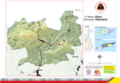
 Viqueque-TL A3 District Map 110813-001.png 4,959 × 3,509; 4.23 MB


_suco.png)
_suco.png)

_suco.png)


_suco.png)


_suco.png)


_-_Munic%C3%ADpio_of_Viqueque.png)


_suco.png)


