Category:Maps of Villers-sous-Saint-Leu
Jump to navigation
Jump to search
Wikimedia category | |||||
| Upload media | |||||
| Instance of | |||||
|---|---|---|---|---|---|
| Category combines topics | |||||
| Villers-sous-Saint-Leu | |||||
commune in Oise, France ,_ch%C3%A2teau-mairie,_rue_de_l%27%C3%89glise.jpg)   | |||||
| Instance of | |||||
| Location | |||||
| Located in or next to body of water | |||||
| Population |
| ||||
| Area |
| ||||
| Elevation above sea level |
| ||||
| official website | |||||
 | |||||
Media in category "Maps of Villers-sous-Saint-Leu"
The following 5 files are in this category, out of 5 total.
-
 60686-Villers-sous-Saint-Leu-Géologie-Leg.pdf 2,481 × 1,754, 2 pages; 2.36 MB
-
 60686-Villers-sous-Saint-Leu-géologie.png 7,015 × 4,960; 5.11 MB
-
 60686-Villers-sous-Saint-Leu-Hydro.jpeg 5,846 × 4,133; 1.83 MB
-
 60686-Villers-sous-Saint-Leu-Sols.png 3,270 × 2,598; 2.24 MB
-
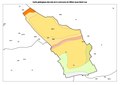
 Map commune FR insee code 60686.png 756 × 605; 33 KB


