Category:Maps of Villeconin
Jump to navigation
Jump to search
Wikimedia category | |||||
| Upload media | |||||
| Instance of | |||||
|---|---|---|---|---|---|
| Category combines topics | |||||
| Villeconin | |||||
commune in Essonne, France _mairie_1116.jpg) .svg)  | |||||
| Instance of | |||||
| Location |
| ||||
| Head of government |
| ||||
| Population |
| ||||
| Area |
| ||||
| Elevation above sea level |
| ||||
| official website | |||||
 | |||||
Media in category "Maps of Villeconin"
The following 12 files are in this category, out of 12 total.
-
 91 Communes Essonne Villeconin.png 723 × 750; 167 KB
-
 91662-Villeconin - Localisation.png 2,500 × 2,480; 1,016 KB
-
 91662-Villeconin-cadastre.png 7,015 × 4,960; 10.09 MB
-
 91662-Villeconin-géologie.png 7,015 × 4,960; 5.46 MB
-
 91662-Villeconin-Hydro.jpeg 5,846 × 4,133; 2.13 MB
-
 91662-Villeconin-Hydro.png 7,015 × 4,960; 3.81 MB
-
 91662-Villeconin-Natura 2000.png 7,015 × 4,960; 3.54 MB
-
 91662-Villeconin-Orthophoto.png 7,015 × 4,960; 10.02 MB
-
 91662-Villeconin-sols.png 7,015 × 4,960; 4.92 MB
-
 91662-Villeconin-ZNIEFF1.png 7,015 × 4,960; 3.95 MB
-
 91662-Villeconin-ZNIEFF2.png 7,015 × 4,960; 4.57 MB
-
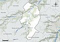
 Map commune FR insee code 91662.png 756 × 605; 64 KB


