Category:Maps of Villard-d'Héry
Jump to navigation
Jump to search
Wikimedia category | |||||
| Upload media | |||||
| Instance of | |||||
|---|---|---|---|---|---|
| Category combines topics | |||||
| Villard-d'Héry | |||||
commune in Savoie, France .JPG)  | |||||
| Instance of | |||||
| Location |
| ||||
| Population |
| ||||
| Area |
| ||||
| official website | |||||
 | |||||
Media in category "Maps of Villard-d'Héry"
The following 12 files are in this category, out of 12 total.
-
 73314-Villard-d'Héry - Localisation.png 3,507 × 2,480; 1.1 MB
-
 73314-Villard-d'Héry-Cadastre.png 7,015 × 4,960; 8.07 MB
-
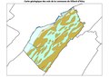 73314-Villard-d'Héry-Géologie-Leg.pdf 1,754 × 1,239, 2 pages; 813 KB
-
 73314-Villard-d'Héry-Géologie.png 7,015 × 4,960; 5.49 MB
-
 73314-Villard-d'Héry-Hydro.jpeg 5,846 × 4,133; 1.58 MB
-
 73314-Villard-d'Héry-Hydro.png 7,015 × 4,960; 4.15 MB
-
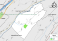 73314-Villard-d'Héry-Natura 2000.png 7,015 × 4,960; 3.44 MB
-
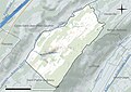
 73314-Villard-d'Héry-Orthophoto.png 7,015 × 4,960; 6.46 MB
-
 73314-Villard-d'Héry-Sols.png 7,015 × 4,960; 4.63 MB
-
 73314-Villard-d'Héry-ZNIEFF1.png 7,015 × 4,960; 3.52 MB
-
 73314-Villard-d'Héry-ZNIEFF2.png 7,015 × 4,960; 3.66 MB
-
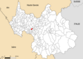
 Map commune FR insee code 73314.png 756 × 605; 48 KB


