Category:Maps of Villabé
Jump to navigation
Jump to search
Wikimedia category | |||||
| Upload media | |||||
| Instance of | |||||
|---|---|---|---|---|---|
| Category combines topics | |||||
| Villabé | |||||
commune in Essonne, France   .svg)  | |||||
| Instance of | |||||
| Location |
| ||||
| Head of government |
| ||||
| Population |
| ||||
| Area |
| ||||
| official website | |||||
 | |||||
Media in category "Maps of Villabé"
The following 23 files are in this category, out of 23 total.
-
 91 Communes Essonne Villabe.png 723 × 750; 166 KB
-
 91659-Villabé - Localisation.png 2,500 × 2,480; 1,017 KB
-
 91659-Villabé-cadastre.png 7,015 × 4,960; 10.58 MB
-
 91659-Villabé-Hydro.jpeg 5,846 × 4,133; 2.65 MB
-
 91659-Villabé-Hydro.png 7,015 × 4,960; 8.59 MB
-
 91659-Villabé-Natura 2000.png 7,015 × 4,960; 4.24 MB
-
 91659-Villabé-Orthophoto.png 7,015 × 4,960; 2.79 MB
-
 91659-Villabé-sols.png 7,015 × 4,960; 8.75 MB
-
 91659-Villabé-Sols.png 3,270 × 2,598; 3.43 MB
-
 91659-Villabé-ZNIEFF1.png 7,015 × 4,960; 4.46 MB
-
 91659-Villabé-ZNIEFF2.png 7,015 × 4,960; 4.57 MB
-
 Carte d'État-major de la France, Feuille Melun S.E - Villabé.jpg 2,559 × 1,706; 3.01 MB
-

-
 Map commune FR insee code 91659.png 756 × 605; 37 KB
-
 Villabe Carte.jpg 733 × 560; 116 KB
-
 Villabé - carte routes-rivières.svg 1,152 × 864; 58 KB
-
 Villabé OSM 01.png 518 × 482; 203 KB
-
 Villabé OSM 02.png 518 × 482; 301 KB
-
 Villabé-cadastre-Napoleon-avec-les-noms.png 5,332 × 4,266; 15.01 MB
-
 Villabé-cadastre-Napoleon-sans-les-noms.png 5,332 × 4,266; 14.62 MB
-
 Villabé-fin-XIXe siècle.jpg 1,500 × 1,690; 535 KB
-
 Villabé-Moulin Galant-Plan bail à rente 1749-rnb.png 1,330 × 1,663; 569 KB
-
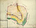 Villabé-Plan-intendance-1785.jpg 3,456 × 2,667; 1.96 MB


