Category:Maps of Victoria Island, Canada
Jump to navigation
Jump to search
Media in category "Maps of Victoria Island, Canada"
The following 14 files are in this category, out of 14 total.
-
 Chart of the Arctic Coast, examined by J. Rae in 1851.png 4,541 × 2,096; 25.03 MB
-
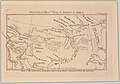 Discoveries of Messrs. Dease and Simpson in 1838-9 (14166789030).jpg 2,500 × 1,745; 1.78 MB
-
 Map indicating Victoria Island, northern Canada.png 428 × 380; 67 KB
-
 Ocean Arctic - Localizacion de l'Ila Victòria.png 975 × 1,005; 483 KB
-
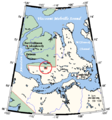
 Victoria Island Canada Paker's Notch.png 1,229 × 1,109; 192 KB
-
 Victoria Island de.svg 668 × 536; 368 KB
-
 Victoria Island, Canada.svg 1,084 × 920; 51 KB
-
 Victoria Island.png 668 × 536; 127 KB
-
 Victoria Island.svg 573 × 499; 138 KB
-
 Victoria ostrov.png 1,280 × 1,063; 54 KB
-
 Victoriaisland.png 320 × 329; 11 KB
-
 VictoriaIslandMap Parker's Notch.png 504 × 540; 27 KB
-
 VictoriaIslandMap.png 504 × 540; 27 KB
-
 Острво Викторија.svg 668 × 536; 1.1 MB

.jpg)


