Category:Maps of Vianen
Jump to navigation
Jump to search
Subcategories
This category has the following 3 subcategories, out of 3 total.
L
M
- Maps of Everdingen (2 F)
- Maps of Hagestein (3 F)
Media in category "Maps of Vianen"
The following 16 files are in this category, out of 16 total.
-
 2013-Vianen.jpg 1,939 × 1,763; 2.32 MB
-
 BAG woonplaatsen - Gemeente Vianen.png 2,419 × 2,419; 498 KB
-
 Gem-Vianen-2014Q1.jpg 3,977 × 3,312; 6.6 MB
-
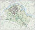 Gem-Vianen-OpenTopo.jpg 4,472 × 3,912; 10.22 MB
-
 Historische kaart Vijfheerenlanden (16e eeuw).jpg 2,953 × 2,808; 5.68 MB
-
 LocatieVianen.png 280 × 130; 9 KB
-
 Map - NL - Municipality code 0620 (2009).svg 300 × 160; 529 KB
-
 Map - NL - Vianen (2009).svg 625 × 575; 1.87 MB
-

-
 Stadsplattegrond naar Blaeu - Vianen - 20241688 - RCE.jpg 1,200 × 892; 375 KB
-
 Vianen 1649 +3 Blaeu.jpg 750 × 514; 194 KB
-
 Vianen Batestein in vogelvlucht op kaart Janssonius 1657.jpg 713 × 595; 245 KB
-
 Vianen Johan Blaeu 1649.jpg 800 × 532; 275 KB
-

-
 Vianen, Gemeenteatlas van Nederland.jpg 2,675 × 2,179; 1.25 MB
-
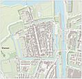 Vianen-centrum-OpenTopo.jpg 2,912 × 2,804; 2.22 MB


.jpg)

.svg)
.svg)


