Category:Maps of Verdun (Ariège)
Jump to navigation
Jump to search
Wikimedia category | |||||
| Upload media | |||||
| Instance of | |||||
|---|---|---|---|---|---|
| Category combines topics | |||||
| Verdun | |||||
commune in Ariège, France .jpg) | |||||
| Instance of | |||||
| Location |
| ||||
| Population |
| ||||
| Area |
| ||||
| Elevation above sea level |
| ||||
| Different from | |||||
| official website | |||||
 | |||||
Media in category "Maps of Verdun (Ariège)"
The following 8 files are in this category, out of 8 total.
-
 09328-Verdun-argile.png 4,076 × 3,307; 5.79 MB
-
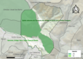
 09328-Verdun-Natura2000.png 3,507 × 2,480; 4.89 MB
-
 09328-Verdun-Natura2000b.png 5,846 × 4,133; 6.17 MB
-
 09328-Verdun-Routes-Hydro.png 3,507 × 2,480; 1.44 MB
-
 09328-Verdun-ZNIEFF1.png 3,519 × 2,480; 4.91 MB
-
 09328-Verdun-ZNIEFF2.png 3,519 × 2,480; 4.89 MB
-
 Map commune FR insee code 09328.png 756 × 605; 49 KB
-
 Quié de Lujat OSM.png 1,060 × 830; 1.63 MB


