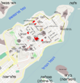
Category:Maps of Valletta
Jump to navigation
Jump to search
Wikimedia category | |||||
| Upload media | |||||
| Instance of | |||||
|---|---|---|---|---|---|
| Category combines topics | |||||
| Valletta | |||||
capital of Malta | |||||
| Instance of | |||||
| Part of |
| ||||
| Named after | |||||
| Patron saint | |||||
| Location | Port Region (Port), Malta | ||||
| Located in or next to body of water | |||||
| Head of government |
| ||||
| Present in work |
| ||||
| Founded by | |||||
| Heritage designation |
| ||||
| Inception |
| ||||
| Significant event | |||||
| Population |
| ||||
| Area |
| ||||
| Elevation above sea level |
| ||||
| official website | |||||
 | |||||
Subcategories
This category has the following 2 subcategories, out of 2 total.
F
- Maps of Fort Saint Elmo (3 F)
O
Media in category "Maps of Valletta"
The following 16 files are in this category, out of 16 total.
-
Admiralty Chart No 974 Valletta Harbours, Published 1909.jpg 11,107 × 16,230; 50.36 MB
-
Lavaletta teil1.jpg 685 × 950; 154 KB
-
Lavaletta teil2.jpg 685 × 950; 140 KB
-
Lavaletta.jpg 1,335 × 881; 301 KB
-
Malta - Valletta - Xatt Lascaris 01 ies.jpg 5,616 × 3,744; 15.19 MB
-
Map valletta malta.png 641 × 578; 10 KB
-
Plan de La Valette et de ses ports - lith. de Kaeppelin - btv1b530878847.jpg 6,216 × 4,144; 2.83 MB
-
St. Andrew's & St. Michael's Bastions Valletta map.png 1,240 × 860; 38 KB
-
St. James Bastion Valletta map.png 1,060 × 1,000; 35 KB
-
St. John's Bastion Valletta map.png 1,432 × 1,160; 45 KB
-
St. Peter & Paul Bastion Valletta map.png 1,548 × 1,256; 63 KB
-
Valletta fortifications map.png 2,920 × 2,164; 391 KB
-
Valletta in Malta.svg 773 × 719; 236 KB
-
Valletta lokalizacja.png 295 × 257; 39 KB
-
Valletta map.png 1,260 × 1,309; 596 KB
-
Valletta-map.svg 743 × 649; 84 KB


