Category:Maps of Valles Marineris
Jump to navigation
Jump to search
Media in category "Maps of Valles Marineris"
The following 28 files are in this category, out of 28 total.
-
 49955 1665rslcontextmap.jpg 1,905 × 900; 667 KB
-
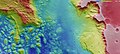
 Aurorae Chaos (THEMIS Day IR with MOLA Color).png 1,794 × 1,013; 5.15 MB
-
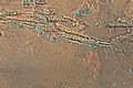
 Aurorae Chaos and Ganges Chasma topography (23155344861).jpg 8,067 × 3,600; 3.75 MB
-
 Aurorae Chaos and Ganges Chasma topography ESA15685861.tiff 8,067 × 3,600; 48.69 MB
-
 Candor Chasm in Coprates.JPG 639 × 480; 68 KB
-
 Candor Chasma in false colour ESA218336.jpg 2,610 × 1,500; 1.35 MB
-
 Candor Chasma in false colour ESA218336.tiff 6,500 × 3,736; 41.8 MB
-
 Cliff in Candor Chasma.JPG 619 × 445; 51 KB
-
 Coprates Chasma (PIA25717 fig1).png 200 × 338; 159 KB
-
 Coprates Chasma (PIA25811 fig1).png 200 × 338; 158 KB
-
 Coprates Chasma and Coprates Catena in context ESA221573.jpg 2,058 × 1,394; 1.82 MB
-
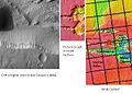
 Coprates map.JPG 638 × 424; 61 KB
-
 Elevation of Melas Chasma region on Mars ESA214943.jpg 3,000 × 1,479; 969 KB
-
 Eos Chasma.JPG 570 × 480; 53 KB
-
 Ganges Chasma.JPG 600 × 462; 48 KB
-
 Louresvallesmola.jpg 1,920 × 1,080; 767 KB
-
 Map valles marineris.JPG 95 × 35; 3 KB
-
 Melas Chasma.JPG 612 × 456; 44 KB
-
 Noctis Labyrinthus (Mars).jpeg 1,044 × 765; 745 KB
-
 Thaumasiamapclose.jpg 1,920 × 1,080; 383 KB
-
 Topographic view of Aurorae Chaos ESA19460195.jpeg 8,013 × 3,600; 11.29 MB
-
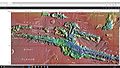
 Topographische Karte der östlichen Ausläufer der Valles Marineris (22818882230).jpeg 1,653 × 1,466; 705 KB
-
 USGS-Mars-MC-18-CopratesRegion-mola.png 2,499 × 1,999; 4.78 MB
-
 USGS-Mars-MC-19-MargartiferSinusRegion-mola.png 2,499 × 1,999; 6.7 MB
-
 Valles Marineris NASA World Wind map Mars.jpg 1,280 × 982; 240 KB
-
 Valles Marineris PIA00178.jpg 7,170 × 4,991; 3.78 MB
-
 Valles marineris topo.jpg 1,024 × 1,059; 738 KB
-
 VallesMarinerisOffsetImpactBasin.png 2,547 × 1,379; 4.14 MB

.png)
.jpg)


.png)
.png)


.jpeg)


.jpeg)


