Category:Maps of Ukrainian-speaking regions
Jump to navigation
Jump to search
Media in category "Maps of Ukrainian-speaking regions"
The following 7 files are in this category, out of 7 total.
-
 East Slavs in Russia 1897-Maloros.jpg 2,096 × 2,392; 1.77 MB
-
 Kuban 1926.png 709 × 394; 183 KB
-
 Silhouette of Grey Ukraine.svg 900 × 583; 30 KB
-
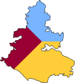 Silhouette of Raspberry Ukraine.svg 900 × 1,004; 27 KB
-
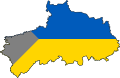
 Silhouette of Yellow Ukraine.svg 900 × 1,320; 46 KB
-
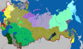 Subdivisions of the Russian Empire by largest ethnolinguistic group (1897).svg 4,648 × 2,744; 693 KB
-
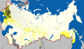 Ukrainian language in the Russian Empire (1897).svg 4,648 × 2,744; 1.4 MB


.svg)
.svg)