Category:Maps of Uganda Protectorate
Jump to navigation
Jump to search
Subcategories
This category has only the following subcategory.
M
Media in category "Maps of Uganda Protectorate"
The following 7 files are in this category, out of 7 total.
-
 Africaorientalbritanica1885-1890.PNG 568 × 1,000; 172 KB
-
 Africaorientalbritanica1895-1902.PNG 599 × 1,000; 148 KB
-
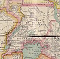
 East Africa Protectorate and Uganda (1898).png 2,830 × 2,608; 8.68 MB
-
 Map of Uganda Protectorate from Harrison and Sons.jpg 827 × 817; 121 KB
-
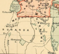 Part of Uganda and Rwanda (1898).png 597 × 545; 623 KB
-
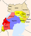 Uganda Protectorate British administration.png 661 × 751; 18 KB
-
 Βρετανικά προτεκτοράτα της Ουγκάντας.png 661 × 751; 39 KB


.png)

.png)

