Category:Maps of Tupai
Jump to navigation
Jump to search
Media in category "Maps of Tupai"
The following 6 files are in this category, out of 6 total.
-
 Atoll research bulletin (1983) (20319213056 brightened).jpg 2,768 × 3,600; 3.72 MB
-
 Atoll research bulletin (1983) (20319213056).jpg 2,782 × 3,613; 641 KB
-
 BoraBora topographic map-fr.svg 714 × 923; 531 KB
-
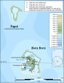
 Societe isl Tupai.PNG 447 × 211; 6 KB
-
 Tupai map atollresearch27328119smit 0422 (brightened).jpg 2,768 × 3,600; 4.28 MB
-
 Tupai map atollresearch27328119smit 0422.jpg 2,782 × 3,613; 782 KB
_(20319213056_brightened).jpg)
_(20319213056).jpg)


.jpg)
