Category:Maps of Tsushima, Nagasaki
Jump to navigation
Jump to search
Media in category "Maps of Tsushima, Nagasaki"
The following 29 files are in this category, out of 29 total.
-
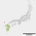
 Provinces of Japan-Tsushima.svg 760 × 794; 117 KB
-
 Tsushima-geo.jpg 315 × 245; 24 KB
-
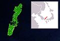
 Tsushima in Nagasaki Prefecture Ja.svg 543 × 499; 15 KB
-
 Fengma Island 1754.jpg 1,105 × 1,082; 154 KB
-
 1838-TenpōTsushima Province.jpg 3,405 × 6,823; 2.85 MB
-
 Admiralty Chart No 2385 Tsu Sima, Published 1901, New Edition 1910.jpg 11,098 × 16,254; 41.38 MB
-
 Admiralty Chart No 3366 Fusan Harbour to Port Hamilton, Published 1904.jpg 16,219 × 11,088; 51.78 MB
-
 Admiralty Chart No 358 Kyushu and Honshu including the Korea Strait, Published 1962.jpg 11,219 × 16,380; 40.46 MB
-
 Admiralty Chart No 874 Plans in Tsu Sima, Published 1913.jpg 16,248 × 11,079; 72.68 MB
-
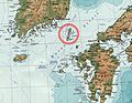
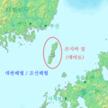
 BusanDaemado.png 199 × 214; 28 KB
-
 Habitat map Tsushima Island.png 600 × 600; 8 KB
-
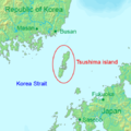
 Isola Tsushima.png 3,040 × 2,170; 1.71 MB
-
 Japan prov map tsushima.png 235 × 300; 6 KB
-
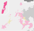
 Map Tsushima, Nagasaki en.png 1,181 × 701; 38 KB
-
 OSM Mount Ariake (Tsushima, Nagasaki).png 360 × 270; 65 KB
-
 Tsushima 1471.jpg 746 × 480; 233 KB
-
 Tsushima fr.png 538 × 540; 229 KB
-
 Tsushima in Nagasaki Prefecture.png 1,181 × 701; 38 KB
-
 Tsushima island de.png 540 × 540; 61 KB
-
 Tsushima island en.png 540 × 540; 59 KB
-
 Tsushima island ja.png 540 × 540; 59 KB
-
 Tsushima island ko.png 540 × 540; 60 KB
-
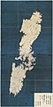
 Tsushima Relief Map, SRTM-1.jpg 600 × 1,200; 271 KB
-
 TsuShima Strait.png 1,008 × 899; 108 KB
-
 Tsushima-sat.jpg 250 × 170; 22 KB
-
 地図 令制国 対馬国.svg 512 × 512; 10 KB
-
 地図-長崎県上県郡.png 364 × 486; 13 KB
-
 地図-長崎県下県郡.png 364 × 486; 13 KB
-
 対馬市.png 323 × 387; 10 KB


.png)