Category:Maps of Trinidad, Trinidad and Tobago
Jump to navigation
Jump to search
Media in category "Maps of Trinidad, Trinidad and Tobago"
The following 24 files are in this category, out of 24 total.
-
 La Trinité - thevet - btv1b8596491v.jpg 2,983 × 2,412; 1.61 MB
-
-
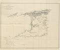
 Map of Trinidad (1888).jpg 1,940 × 1,268; 1.07 MB
-

-

-
 A Chart of the Isle of Trinidad... - btv1b53122297d.jpg 7,828 × 5,670; 4.25 MB
-
 A Chart of the Isle of Trinidad... - btv1b53122298v.jpg 8,312 × 6,502; 4.77 MB
-
 A map of Trinidad - btv1b530633293.jpg 11,744 × 8,168; 9.61 MB
-
 A Map of Trinidad - btv1b53064602m.jpg 11,587 × 8,194; 12.57 MB
-
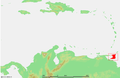 Caribbean - Trinidad.PNG 929 × 606; 48 KB
-
 East-West Corridor.PNG 744 × 546; 18 KB
-
 FSO Nabarima location.png 995 × 692; 978 KB
-
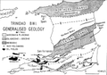 Generalized geology of Trinidad.png 814 × 570; 115 KB
-
 Karte Golf von Paria.png 995 × 692; 702 KB
-

-
 Regional corporations and municipalities of Trinidad.svg 6,183 × 4,967; 195 KB
-
 Trinidad Communities Map (2024).svg 3,155 × 2,265; 6.81 MB
-
 Trinidad map.png 1,100 × 817; 490 KB
-
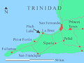 Trinidad pitch lake ENG.png 480 × 360; 143 KB
-
 Trinidad pitch lake GER.png 480 × 360; 145 KB
-
 Trinidad rail map 1925.jpg 1,026 × 868; 173 KB
-
 TrinTobRegCorp.PNG 744 × 546; 18 KB
-
 TTOilandGas.JPG 709 × 654; 76 KB
-
 Île de la Trinité - btv1b531216964.jpg 7,994 × 6,074; 3.68 MB

.jpg)
.jpg)
.jpg)


.svg)


