Category:Maps of Tourcoing
Jump to navigation
Jump to search
Wikimedia category | |||||
| Upload media | |||||
| Instance of | |||||
|---|---|---|---|---|---|
| Category combines topics | |||||
| Tourcoing | |||||
commune in Nord department, Hauts-de-France, France | |||||
| Instance of | |||||
| Location |
| ||||
| Head of government |
| ||||
| Population |
| ||||
| Area |
| ||||
| Elevation above sea level |
| ||||
| official website | |||||
 | |||||
Subcategories
This category has only the following subcategory.
Media in category "Maps of Tourcoing"
The following 14 files are in this category, out of 14 total.
-
59599-Tourcoing-Hydro.jpeg 5,846 × 4,133; 4.49 MB
-
59599-Tourcoing-Sols.png 3,270 × 2,598; 8.74 MB
-
Canal de Roubaix location.jpg 1,000 × 716; 312 KB
-
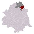
Map commune FR insee code 59599.png 756 × 605; 79 KB
-
Plan de destruction de Karl Mack.jpg 838 × 1,174; 516 KB
-
Plan de tourcoing.jpg 751 × 600; 37 KB
-
Tourcoing dot.png 1,804 × 1,689; 164 KB
-
Tourcoing en 1804.png 690 × 533; 596 KB
-
Tourcoing en 1830.png 648 × 463; 799 KB
-
Tourcoing en 1850 sur plan cadastral.png 639 × 537; 683 KB
-
Tourcoing en 1922.png 740 × 520; 895 KB
-
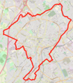
Tourcoing OSM 01.png 1,080 × 1,231; 2.23 MB
-
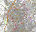
Tourcoing OSM 02.png 744 × 651; 697 KB
-
Tourcoing.jpg 700 × 700; 137 KB


