Category:Maps of Toulouse
Jump to navigation
Jump to search
Wikimedia category | |||||
| Upload media | |||||
| Instance of | |||||
|---|---|---|---|---|---|
| Category combines topics | |||||
| Toulouse | |||||
French commune and city in Haute-Garonne, Occitania   .jpeg)    .svg)   | |||||
| Pronunciation audio | |||||
| Instance of | |||||
| Location |
| ||||
| Located in or next to body of water | |||||
| Visitor center | |||||
| Head of government | |||||
| Significant event |
| ||||
| Population |
| ||||
| Area |
| ||||
| Elevation above sea level |
| ||||
| Replaces |
| ||||
| official website | |||||
 | |||||
Subcategories
This category has the following 13 subcategories, out of 13 total.
A
- Attraction maps of Toulouse (2 F)
C
- City maps of Toulouse (6 F)
E
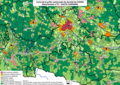
- Ecological maps of Toulouse (3 F)
G
- Geological maps of Toulouse (1 F)
M
- Maps of land use in Toulouse (2 F)
- Maps of quarters of Toulouse (21 F)
O
T
- Topographic maps of Toulouse (2 F)
U
Media in category "Maps of Toulouse"
The following 16 files are in this category, out of 16 total.
-
 31 HAUTE-GARONNE carte grille communale densite INSEE.png 3,507 × 2,480; 4.52 MB
-
 31044-Balma-Sols.png 7,015 × 4,960; 21.24 MB
-
 31555-Toulouse-Sols.png 7,015 × 4,960; 27.47 MB
-
 Agglomération de Toulouse.svg 744 × 1,052; 248 KB
-
 Carte de Toulouse.svg 2,368 × 2,566; 62.46 MB
-
 Carte toulouse.png 720 × 540; 78 KB
-
 Diocèse Toulouse 1789.svg 2,000 × 1,922; 801 KB
-
 Jardin Niel (OSM 2023-06-17).jpg 1,768 × 1,362; 365 KB
-
 Map commune FR insee code 31555.png 756 × 605; 194 KB
-

-
 Plan métro tramway Toulouse.svg 2,237 × 1,678; 351 KB
-
 Situation et accès du quartier OPPIDEA.mairie de Toulouse.jpg 453 × 506; 53 KB
-
 Toulouse dot.png 1,804 × 1,689; 164 KB
-
 Toulouse dot2.png 698 × 717; 435 KB
-
 Toulouse map.png 200 × 189; 18 KB
-
 Vue de la ville de Toulouse par Nicolas Bertrand.jpg 1,024 × 1,510; 494 KB


.jpg)


