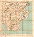
Category:Maps of Torquay
Jump to navigation
Jump to search
Media in category "Maps of Torquay"
The following 15 files are in this category, out of 15 total.
-
26 of 'Illustrated guide to Torquay and neighbourhood' (11167923625).jpg 1,384 × 2,343; 810 KB
-
28 of 'Illustrated guide to Torquay and neighbourhood' (11168775506).jpg 1,638 × 1,485; 515 KB
-
27 of 'Illustrated guide to Torquay and neighbourhood' (11173332995).jpg 1,466 × 2,291; 880 KB
-
Map Torquay 1860.jpg 2,000 × 1,091; 642 KB
-
Map-of-torquay.png 1,024 × 768; 277 KB
-
Ordnance Survey One-Inch Sheet 145 Torquay & Dartmouth, Published 1924.jpg 9,362 × 10,136; 9.19 MB
-
Ordnance Survey One-Inch Sheet 188 Torbay, Published 1972.jpg 11,009 × 13,179; 44.24 MB
-
Ordnance Survey One-Inch Sheet 188 Torquay, Published 1946.jpg 8,209 × 9,562; 10.84 MB
-
Ordnance Survey One-Inch Sheet 188 Torquay, Published 1961.jpg 8,337 × 9,921; 10.32 MB
-
Ordnance Survey One-Inch Sheet 188 Torquay, Published 1968.jpg 8,407 × 9,964; 10.7 MB
-
Ordnance Survey Sheet SX 86 96 Torbay, Published 1970.jpg 14,801 × 7,047; 30.05 MB
-
St Matthew in Chelston, location.png 2,506 × 1,392; 2.73 MB
-
The Quarterly journal of the Geological Society of London (1907) (14590702118).jpg 2,124 × 3,584; 1.56 MB


