Category:Maps of Toba, Mie
Appearance
Wikimedia category | |||||
| Upload media | |||||
| Instance of | |||||
|---|---|---|---|---|---|
| Category combines topics | |||||
| Toba | |||||
city in Mie Prefecture, Japan | |||||
| Instance of |
| ||||
| Located in protected area | |||||
| Location |
| ||||
| Legal form |
| ||||
| Inception |
| ||||
| Population |
| ||||
| Area |
| ||||
| Replaces |
| ||||
| Different from | |||||
| official website | |||||
 | |||||
Media in category "Maps of Toba, Mie"
The following 23 files are in this category, out of 23 total.
-
Daini Ise Road Map.png 2,889 × 1,953; 783 KB
-
Kagamiura village, Mie 01.png 2,449 × 2,725; 184 KB
-
Kamo 20220702174824 (52268744788).jpg 4,032 × 3,024; 3.41 MB
-
Kamo village, Mie.png 2,449 × 2,725; 185 KB
-
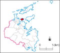
Map of Kamishima-cho.png 730 × 646; 38 KB
-
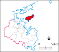
Map of Kuzaki-cho.png 730 × 646; 38 KB
-
Map of Sakate-cho.png 730 × 646; 38 KB
-
Map of Sugashima-cho.png 730 × 646; 38 KB
-
Map of Toba - panoramio.jpg 3,072 × 2,304; 1.63 MB
-
Map of Toba Port, Mie.jpg 1,007 × 964; 133 KB
-
Nagaoka village, Mie.png 2,449 × 2,725; 183 KB
-
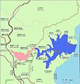
The map of Matoya Bay.GIF 655 × 469; 13 KB
-
The map of Matoya Bay.jpg 826 × 868; 91 KB
-
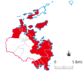
Toba elementary school district.png 730 × 646; 57 KB
-
Toba in Mie Prefecture Ja.png 192 × 335; 28 KB
-
Toba in Mie Prefecture Ja.svg 460 × 802; 15 KB
-
Toba in Mie Prefecture.png 981 × 901; 39 KB
-
Toba Municipal Ship Line.png 681 × 624; 102 KB
-
Toba Port Map.png 477 × 730; 22 KB
-
Toba town, Mie.png 2,449 × 2,725; 184 KB
-
Tobahigashi JHS school district.png 730 × 646; 60 KB
-
Tobaminami-Shiraki IC map.png 2,864 × 2,344; 467 KB
-
地図-三重県鳥羽市-2006.png 206 × 277; 7 KB


