Category:Maps of Thuringia (1920–1952)
Jump to navigation
Jump to search
Media in category "Maps of Thuringia (1920–1952)"
The following 25 files are in this category, out of 25 total.
-
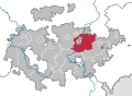
 CountyLocatorThuringia1922-ABG.svg 813 × 595; 36 KB
-
 CountyLocatorThuringia1922-ARN.svg 813 × 595; 36 KB
-
 CountyLocatorThuringia1922-Camburg.svg 813 × 595; 36 KB
-
 CountyLocatorThuringia1922-ESA.svg 813 × 595; 36 KB
-
 CountyLocatorThuringia1922-G.svg 813 × 595; 36 KB
-
 CountyLocatorThuringia1922-GRZ.svg 813 × 595; 36 KB
-
 CountyLocatorThuringia1922-GTH.svg 813 × 595; 36 KB
-
 CountyLocatorThuringia1922-HBN.svg 813 × 595; 36 KB
-
 CountyLocatorThuringia1922-MGN.svg 813 × 595; 36 KB
-
 CountyLocatorThuringia1922-RU.svg 813 × 595; 36 KB
-
 CountyLocatorThuringia1922-SCZ.svg 813 × 595; 36 KB
-
 CountyLocatorThuringia1922-SDH.svg 813 × 595; 36 KB
-
 CountyLocatorThuringia1922-SLF.svg 813 × 595; 36 KB
-
 CountyLocatorThuringia1922-SON.svg 813 × 595; 36 KB
-
 CountyLocatorThuringia1922-SRO.svg 813 × 595; 36 KB
-
 CountyLocatorThuringia1922-WE.svg 813 × 595; 36 KB
-
 GliederungThueringen1922-es.svg 3,951 × 2,800; 224 KB
-
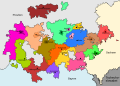 GliederungThueringen1922.svg 3,951 × 2,800; 82 KB
-
 Lange diercke sachsen deutschland bodenverhaeltnisse 2 (Thüringen).jpg 602 × 650; 296 KB
-
 Map-WR-Thuringia.svg 1,185 × 1,007; 541 KB
-
 THUERINGEN1952.png 1,389 × 1,208; 72 KB
-
 Thuringia in the German Reich (1925).svg 1,425 × 1,133; 967 KB
-
 THUERINGEN1920.png 1,486 × 1,030; 42 KB
-
 Thüringen 1920.svg 1,400 × 1,000; 46 KB
-
 Thüringen in German Democratic Republic 1949 - 1952.svg 618 × 789; 574 KB


.jpg)


.svg)


