Category:Maps of Thun Quarters
Jump to navigation
Jump to search
Subcategories
This category has the following 2 subcategories, out of 2 total.
2
Media in category "Maps of Thun Quarters"
The following 18 files are in this category, out of 18 total.
-
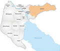
Karte Thun Quartiere 2024.png 1,476 × 1,216; 325 KB
-
Karte Thun Quartiere Aarefeld.png 1,181 × 1,005; 353 KB
-
Karte Thun Quartiere Allmendingen.png 1,181 × 1,005; 344 KB
-
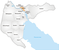
Karte Thun Quartiere Altstadt.png 1,181 × 1,005; 353 KB
-
Karte Thun Quartiere Buchholz.png 1,181 × 1,005; 348 KB
-
Karte Thun Quartiere Bälliz Freienhofgasse.png 1,181 × 1,005; 354 KB
-
Duerrenast thun.PNG 1,062 × 910; 184 KB
-
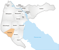
Karte Thun Quartiere Dürrenast.png 1,181 × 1,005; 347 KB
-
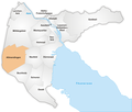
Karte Thun Quartiere Goldiwil.png 1,181 × 1,005; 343 KB
-
Karte Thun Quartiere Gwatt.png 1,181 × 1,005; 346 KB
-
Karte Thun Quartiere Hohmad.png 1,181 × 1,005; 351 KB
-
Karte Thun Quartiere Lauenen-Hofstetten-Ried.png 1,181 × 1,005; 350 KB
-
Karte Thun Quartiere Lerchenfeld.png 1,181 × 1,005; 351 KB
-
Karte Thun Quartiere Militärgebiet.png 1,181 × 1,005; 341 KB
-
Karte Thun Quartiere Neufeld.png 1,181 × 1,005; 349 KB
-
Karte Thun Quartiere Schoren.png 1,181 × 1,005; 348 KB
-
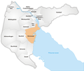
Karte Thun Quartiere Seefeld.png 1,181 × 1,005; 353 KB
-
Karte Thun Quartiere Westquartier.png 1,181 × 1,005; 349 KB


