Category:Maps of Thrissur district
Jump to navigation
Jump to search
Wikimedia category | |||||
| Upload media | |||||
| Instance of | |||||
|---|---|---|---|---|---|
| Category combines topics | |||||
| Thrissur district | |||||
district of Kerala, India | |||||
| Instance of | |||||
| Location |
| ||||
| Capital | |||||
| Population |
| ||||
| Area |
| ||||
| Different from | |||||
| official website | |||||
 | |||||
Subcategories
This category has the following 2 subcategories, out of 2 total.
- Maps of Thrissur (11 F)
Media in category "Maps of Thrissur district"
The following 29 files are in this category, out of 29 total.
-
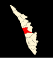
06-thrissur.png 747 × 1,007; 101 KB
-
06-thrissur.svg 744 × 1,052; 55 KB
-
Admiralty Chart No 798 Cranganor Mud Bank, Published 1775.jpg 4,162 × 5,122; 3.52 MB
-
AMH-2589-NA Ground plan of the fort at Cranganoor.jpg 2,400 × 1,841; 769 KB
-
Bharathapuzha map.PNG 717 × 444; 199 KB
-
BlankMapThrissurSubdistricts.svg 759 × 495; 101 KB
-
Chalakkudy-Assembly-Segments-en.png 1,020 × 795; 106 KB
-
Chalakkudy-Assembly-Segments-en.svg 1,020 × 794; 26 KB
-
Chalakkudy-Assembly-Segments-ml.png 1,020 × 742; 109 KB
-
Chalakkudy-Assembly-Segments-ml.svg 1,020 × 741; 24 KB
-
Chalakkudypuzha map.PNG 880 × 491; 208 KB
-
Cranganor, Plan de la forteresse de Cranganor. 1709.jpg 4,363 × 2,981; 4.76 MB
-
India Kerala Thrissur district.svg 874 × 1,274; 539 KB
-
Kodungallur-municipality.png 26,400 × 17,700; 9.46 MB
-
Malabar District (1951 Census).svg 1,164 × 1,655; 3.24 MB
-
Rivers of Thrissur.png 10,323 × 8,265; 3.91 MB
-
Subdistricts of Thrissur.svg 3,588 × 2,329; 162 KB
-
Thrissur district location map.svg 700 × 766; 1.72 MB
-
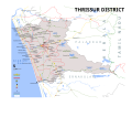
Thrissur District map 1.png 12,063 × 9,688; 10.43 MB
-
THRISSUR DISTRICT MAP VECTOR.svg 3,600 × 3,168; 16.22 MB
-
Thrissur District map.png 13,786 × 11,072; 12.16 MB
-
THRISSUR DISTRICT MAP.png 13,786 × 11,072; 12.79 MB
-
Thrissur district.png 2,000 × 2,428; 826 KB
-
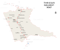
Thrissur Railway Map.png 8,556 × 7,201; 1.64 MB
-
Thrissur Rivers and Lakes Map.png 10,328 × 8,267; 3.9 MB
-
THRISSUR RIVERS MAP VECTOR.svg 3,099 × 2,481; 9.77 MB
-
Thrissur Taluk map.png 10,323 × 8,263; 2.06 MB
-
Thrissur taluks map coloured.png 10,353 × 8,300; 2.25 MB
-
THRISSUR TALUKS MAP VECTOR.svg 3,102 × 2,491; 9.73 MB


