Category:Maps of Thailand during World War II
Jump to navigation
Jump to search
Media in category "Maps of Thailand during World War II"
The following 14 files are in this category, out of 14 total.
-
Burma Front Map.png 1,000 × 1,445; 436 KB
-
Death Railway.png 1,000 × 1,300; 530 KB
-
French Indochina subdivisions ww2-es.svg 667 × 1,017; 547 KB
-
French Indochina subdivisions ww2.svg 667 × 1,017; 81 KB
-
Japanese Invasion of Thailand 8 Dec 1941.png 548 × 800; 43 KB
-
Kingdom of Thailand in World War II map.png 330 × 715; 72 KB
-
Kingdom of Thailand World War II orthographic map.png 541 × 541; 112 KB
-
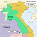
Laos 1941-46.png 1,003 × 996; 162 KB
-
Pacific War - Southern Asia 1942 - Map.jpg 1,260 × 961; 183 KB
-
Provinces of Cambodia loss to Thailand during Franco-Thai War Km.png 1,200 × 900; 4.14 MB
-
Provinces of Cambodia loss to Thailand during Franco-Thai War.png 1,200 × 900; 187 KB
-
Saharat Thai Doem map.png 962 × 870; 189 KB
-
Sirat Malai and Malaya.png 549 × 627; 57 KB
-
State of Thailand map.png 621 × 344; 49 KB


