Category:Maps of Thèbe (Hautes-Pyrénées)
Jump to navigation
Jump to search
Subcategories
This category has the following 4 subcategories, out of 4 total.
Media in category "Maps of Thèbe (Hautes-Pyrénées)"
The following 4 files are in this category, out of 4 total.
-
 65441-Thèbe - Localisation.png 2,000 × 2,480; 1.04 MB
-
 65441-Thèbe-Cadastre.png 7,015 × 4,960; 6.58 MB
-
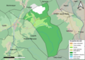 65441-Thèbe-Sols.png 7,015 × 4,960; 4.04 MB
-
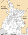
 Map commune FR insee code 65441.png 756 × 605; 40 KB


