Category:Maps of Texcoco
Jump to navigation
Jump to search
Subcategories
This category has only the following subcategory.
M
- Maps of Texcoco Lake, Mexico (35 F)
Media in category "Maps of Texcoco"
The following 4 files are in this category, out of 4 total.
-
 Gemeente Texcoco.PNG 377 × 385; 14 KB
-
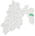
 Location Texcoco de Mora.png 278 × 183; 16 KB
-
 Mexico Estado de Mexico Texcoco location map.svg 2,506 × 2,504; 495 KB
-
 Ubicacion molino de flores.jpg 644 × 536; 65 KB


