Category:Maps of Taurignan-Castet
Jump to navigation
Jump to search
Wikimedia category | |||||
| Upload media | |||||
| Instance of | |||||
|---|---|---|---|---|---|
| Category combines topics | |||||
| Taurignan-Castet | |||||
commune in Ariège, France .jpg)  | |||||
| Instance of | |||||
| Location |
| ||||
| Population |
| ||||
| Area |
| ||||
| Elevation above sea level |
| ||||
 | |||||
Media in category "Maps of Taurignan-Castet"
The following 10 files are in this category, out of 10 total.
-
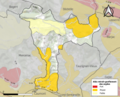 09307-Taurignan-Castet-argile.png 4,076 × 3,307; 5.26 MB
-
 09307-Taurignan-Castet-Natura2000.png 3,507 × 2,480; 5.1 MB
-
 09307-Taurignan-Castet-Natura2000b.png 5,846 × 4,133; 6.57 MB
-
 09307-Taurignan-Castet-Routes-Hydro.png 3,507 × 2,480; 1.69 MB
-
 09307-Taurignan-Castet-ZNIEFF1.png 3,519 × 2,480; 5.13 MB
-
 09307-Taurignan-Castet-ZNIEFF2.png 3,519 × 2,480; 4.72 MB
-
 Map commune FR insee code 09307.png 756 × 605; 46 KB
-
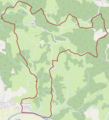 Taurignan-Castet OSM 01.png 902 × 994; 901 KB
-
 Taurignan-Castet OSM 02.png 902 × 994; 1.8 MB
-
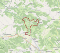 Taurignan-Castet OSM 03.png 802 × 706; 905 KB


