Category:Maps of Tanintharyi Region
Jump to navigation
Jump to search
Media in category "Maps of Tanintharyi Region"
The following 23 files are in this category, out of 23 total.
-
 Admiralty Chart No 216a Mergui Archiplelago Northern Part, Published 1830, New Edition 1938.jpg 11,070 × 16,267; 53.66 MB
-
 Bokpyin district in Tanintharyi region.svg 354 × 531; 330 KB
-
 Bokpyin district.svg 346 × 257; 69 KB
-
 Bokpyin tsp in Kawthoung district.svg 573 × 508; 122 KB
-
 Dawei district in Tanintharyi region.svg 549 × 748; 316 KB
-
 Dawei district.svg 354 × 358; 62 KB
-
 Dawei tsp in Dawei district.svg 859 × 1,253; 56 KB
-

-
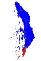 Kawthong district in Tanintharyi region 2022.svg 354 × 531; 330 KB
-
 Kawthoung district 2022.svg 402 × 366; 65 KB
-
 Kawthoung district in Tanintharyi region.svg 606 × 719; 319 KB
-
 Kawthoung tsp in Kawthoung district.svg 351 × 473; 98 KB
-
 Kyunsu tsp in Myeik district.svg 987 × 775; 153 KB
-
 Launglon tsp in Dawei district.svg 335 × 571; 56 KB
-
 Myeik district in Tanintharyi region.svg 432 × 574; 319 KB
-
 Myeik district.svg 773 × 744; 158 KB
-
 Myeik tsp in Myeik district.svg 930 × 744; 153 KB
-
 Palaw tsp in Myeik district.svg 857 × 744; 153 KB
-
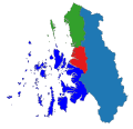
 Tanintharyi region districts 2022.svg 354 × 531; 330 KB
-
 Tanintharyi Region Districts Map.svg 1,052 × 1,353; 315 KB
-
 Tanintharyi tsp in Myeik district.svg 759 × 722; 152 KB
-
 Thayatchaung tsp in Dawei district.svg 794 × 1,080; 56 KB
-
 Yebyu tsp in Dawei district 1.svg 1,334 × 1,712; 56 KB


