Category:Maps of Talas Region
Jump to navigation
Jump to search
Media in category "Maps of Talas Region"
The following 9 files are in this category, out of 9 total.
-
 Blank map of Talas Region (with districts).svg 3,024 × 1,512; 34 KB
-
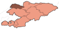
 Blank map of Talas Region.svg 3,024 × 1,512; 19 KB
-
 KG-Talas-Bakay-Ata.svg 596 × 303; 479 KB
-
 KG-Talas-Kara-Buura.svg 621 × 270; 721 KB
-
 KG-Talas-Manas.svg 963 × 326; 609 KB
-
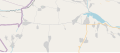
 KG-Talas-Talas.svg 741 × 228; 847 KB
-
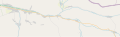
 Kgz-t.gif 385 × 191; 8 KB
-
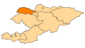
 KyrgyzstanTalas.png 530 × 300; 29 KB
-
 KyrgyzstanTalas.svg 530 × 300; 22 KB


.svg)