Category:Maps of Syracuse, New York
Jump to navigation
Jump to search
- Cities in New York State
- ‒ Capital District
- Albany
- Cohoes
- Saratoga Springs
- Schenectady
- Troy
- ‒ Central New York
- Ithaca
- Syracuse
- ‒ New York City and Long Island
- New York City
- ‒ Finger Lakes
- Rochester
- ‒ Hudson Valley
- New Rochelle
- ‒ Mohawk Valley
- Utica
- ‒ North Country
- Plattsburgh
- ‒ Southern Tier
- Elmira
- ‒ Western New York
- Buffalo
- Niagara Falls
- North Tonawanda
Wikimedia category | |||||
| Upload media | |||||
| Instance of | |||||
|---|---|---|---|---|---|
| Category combines topics | |||||
| Syracuse | |||||
city in and county seat of Onondaga County, New York, United States | |||||
| Instance of |
| ||||
| Named after | |||||
| Location | Onondaga County, New York | ||||
| Head of government | |||||
| Inception |
| ||||
| Population |
| ||||
| Area |
| ||||
| Elevation above sea level |
| ||||
| official website | |||||
 | |||||
Subcategories
This category has the following 2 subcategories, out of 2 total.
Media in category "Maps of Syracuse, New York"
The following 25 files are in this category, out of 25 total.
-
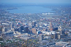
Birds eye view of Syracuse, New York (2675865078).jpg 2,000 × 1,398; 3.25 MB
-
Columbus Circle Map.png 2,000 × 2,000; 287 KB
-
Oakwood-map-1912.jpg 4,795 × 2,965; 6.24 MB
-
Syracuse 1874 state-school.jpg 527 × 490; 221 KB
-
Syracuse Downtown Location.gif 865 × 891; 10 KB
-
Syracuse Eastwood Location.gif 865 × 891; 11 KB
-
Syracuse Lincoln Park Location.gif 865 × 891; 11 KB
-
Syracuse map neighborhoods.gif 577 × 599; 45 KB
-
Syracuse map neighborhoods.png 490 × 509; 75 KB
-
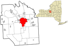
Syracuse map state.gif 360 × 271; 12 KB
-
Syracuse Meadowbrook Location.gif 865 × 891; 10 KB
-
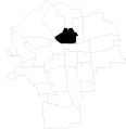
Syracuse Near Northeast Location.gif 865 × 891; 10 KB
-
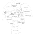
Syracuse Neighborhoods Labeled.gif 865 × 891; 25 KB
-
Syracuse NewYork.svg 635 × 477; 462 KB
-
Syracuse North Valley Location.gif 865 × 891; 10 KB
-
Syracuse Skunk City Location.gif 865 × 891; 10 KB
-
Syracuse University Hill Location.gif 865 × 891; 10 KB
-
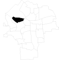
Syracuse Westside Location.gif 865 × 891; 10 KB
-
Syracuse, New York 1955 Yellow Book.jpg 800 × 1,028; 188 KB
-
SyracuseHighways.jpg 564 × 308; 20 KB
-
Thornden-Park-map-2018.jpg 3,501 × 2,150; 3.18 MB
-
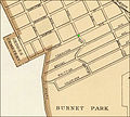
Tipp-hill 1890-0618 burnet.jpg 1,478 × 1,124; 649 KB
-
Tipp-hill 1895 map.jpg 411 × 371; 104 KB
