Category:Maps of Sulawesi
Jump to navigation
Jump to search
Wikimedia category | |||||
| Upload media | |||||
| Instance of | |||||
|---|---|---|---|---|---|
| Category combines topics | |||||
| Sulawesi | |||||
one of the four Greater Sunda Islands, governed by Indonesia | |||||
| Instance of | |||||
| Part of | |||||
| Location | Indonesia | ||||
| Located in or next to body of water | |||||
| Highest point |
| ||||
| Population |
| ||||
| Area |
| ||||
| Elevation above sea level |
| ||||
| Different from | |||||
 | |||||
May only include maps that focus on the island of Sulawesi. If other major islands of Indonesia are visible, use other categories, such as Category:Maps of eastern Indonesia. If showing the location of Sulawesi in relation with Indonesia, use Category:Locator maps of Sulawesi. If not showing the whole of Sulawesi, use the province level category(/categories).
Subcategories
This category has the following 15 subcategories, out of 15 total.
Media in category "Maps of Sulawesi"
The following 28 files are in this category, out of 28 total.
-
Biogeografi sulawesi.png 2,046 × 2,986; 252 KB
-
Distribution Tarsius.png 1,000 × 1,105; 129 KB
-
Earthquake Sulawesi 2018-09-28-Epicentral region.jpg 5,320 × 5,832; 2.58 MB
-
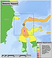
Earthquake Sulawesi 2018-09-28-Seismic hazard.jpg 2,512 × 2,828; 685 KB
-
Figure 1 Daryono et al. 2021.png 964 × 431; 575 KB
-
Gempa bumi di Sulawesi 1970-.png 954 × 1,200; 1.1 MB
-
Gulf of Boni's map.PNG 348 × 273; 140 KB
-
Gulf of Tomini's map.PNG 457 × 302; 129 KB
-
Kawasan Teluk Bone.jpg 4,433 × 4,238; 785 KB
-
Neck of Sulawesi.jpg 3,359 × 6,157; 14.24 MB
-
Peta bahasa Pamona.png 2,048 × 2,048; 447 KB
-
Peta Lokasi Modisi.jpg 1,080 × 1,692; 394 KB
-
Sulavesis.png 548 × 758; 76 KB
-
Sulawesi blank map.png 1,000 × 1,105; 114 KB
-
Sulawesi blank.PNG 1,492 × 1,647; 54 KB
-
Sulawesi kaart.png 1,492 × 1,647; 172 KB
-
Sulawesi Locator Topography.png 1,991 × 1,858; 1.88 MB
-
Sulawesi map big.png 633 × 756; 132 KB
-
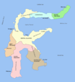
Sulawesi map id.png 1,492 × 1,647; 178 KB
-
Sulawesi map.PNG 1,492 × 1,647; 83 KB
-
Sulawesi topography plain 2.png 2,179 × 2,646; 2.6 MB
-
Sulawesi topography plain.png 2,219 × 2,799; 2.85 MB
-
Sulawesi Topography.png 2,153 × 1,990; 1.71 MB
-
Sulawesi Utara 2010 chrétiens.png 2,161 × 1,828; 949 KB
-
Sulawesi.jpg 312 × 304; 15 KB
-
Talaud Islands.PNG 140 × 149; 22 KB
-
Tunipalangga's conquests.png 516 × 778; 392 KB
-
Сулавеси.png 1,529 × 1,618; 1.82 MB


