Category:Maps of Subdivisions of East Timor (2015–2022)
Jump to navigation
Jump to search
Media in category "Maps of Subdivisions of East Timor (2015–2022)"
The following 9 files are in this category, out of 9 total.
-
 2015 East Timor Dili locator map.png 3,344 × 1,929; 176 KB
-
 2015 East Timor municipalities numbers.png 3,344 × 1,929; 224 KB
-
 2015 East Timor, administrative divisions - de - colour.tif 3,344 × 1,929; 18.46 MB
-
 2015 East Timor, administrative divisions - de - monochrom.tif 3,344 × 1,929; 18.46 MB
-
 East Timor, administrative divisions (since 2015) - th - colored.svg 1,714 × 757; 865 KB
-
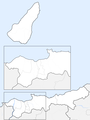 Map of Timor-Leste - administrative (since 2015) - Município of Dili.png 2,565 × 3,419; 341 KB
-

-
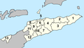
 Municipalities of Timor-Leste.png 3,344 × 1,929; 173 KB
-
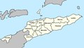
 Timor-Leste municipalities numbered 2015.png 3,344 × 1,929; 212 KB


_-_th_-_colored.svg)
_-_Munic%C3%ADpio_of_Dili.png)
_-_Munic%C3%ADpios_and_Posto_Administrativos_(with_names).png)

