Category:Maps of States in Sudan (without district borders)
Jump to navigation
Jump to search
Media in category "Maps of States in Sudan (without district borders)"
The following 20 files are in this category, out of 20 total.
-
 Sudan states numbered.png 491 × 600; 139 KB
-
 Sudan states.png 491 × 600; 127 KB
-
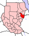
 Al-Bahr al-Ahmar.PNG 491 × 600; 150 KB
-
 Al-Chartum.PNG 491 × 600; 137 KB
-
 Al-Dschazira.PNG 491 × 600; 137 KB
-
 Al-Dschazira.svg 750 × 916; 55 KB
-
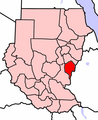
 Al-Qadarif.PNG 491 × 600; 137 KB
-
 An-Nil al-Abyad.PNG 491 × 600; 137 KB
-
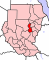
 An-Nil al-Azraq.PNG 491 × 600; 137 KB
-
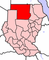 Asch-Schamaliya.PNG 491 × 600; 137 KB
-
 Dschanub Darfur.PNG 491 × 600; 138 KB
-
 Gharb Darfur.PNG 491 × 600; 137 KB
-
 Kassala.PNG 491 × 600; 137 KB
-
 Locator map Sudan North Kurdufan (CPA).png 683 × 600; 142 KB
-
 Locator map Sudan South Kurdufan (CPA).png 683 × 600; 141 KB
-
 Nahr an-Nil.PNG 491 × 600; 150 KB
-
 Northern Sudan states numbered.svg 1,593 × 1,411; 52 KB
-
 Schamal Darfur.PNG 491 × 600; 151 KB
-
 Sinnar.PNG 491 × 600; 150 KB
-
 Sudan-karte-politisch-dschanub-darfur.png 624 × 411; 190 KB


.png)
.png)


